bin

Creek in suburban Collin County, Texas, USA

Sponsored by

United States, Texas, Plano

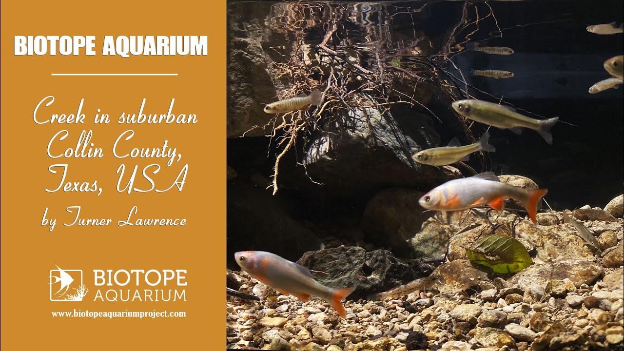
Plano, Texas resides in the Blackland Prarie; an ecosystem well known for its diversity. Most recognizable habitats in this area vary from dense grasslands to plains. Although naturally occurring aquatic habitats are uncommon, the construction of urban drainage systems have aided in the growth of pre-existing creeks. The main groups of fish present are Lepomis sp, Cyprinella sp, and Fundulus sp.

Riparian grasses and shrubs surround almost all bodies of water. The prevalence of limestone as a base rock of Texas has led to waters being rich in minerals and due to being soft, as it is very easily eroded. Threats to these habitats include said erosion; however the main threat is urbanization, as both trash and chemicals are likely to enter these waters.

Submitted by
Turner Lawrence
Approved by
Fritz Rohde & Lawrence Kent
GPS
33.0268402, -96.6776352
Geographical region
Northern America
Drainage Basin
River catchment
Water body type
Creek
Water body name
Willow Creek
Water body part
Meander
Water body course
Middle course
Water body: tributary of
Creek
Tributary name

Videos above and below water

Water Chemistry

Water information

Water type
Fresh water
Water color
Clear water
Water transparency
High
Concentration of sediments
Medium
Water temperature
73 °C
Water flow/curent
Slow

Chemical parameters

pH
7.9
Conductivity
580
GH
215 mg/l
KH
197 mg/l
Dissolved Oxygen

Substrate in nature

Sand
White
Pebble/Gravel
White
Stone
Beige
Stone form
Irregular
Silt/Mud
Beige
Leaves
Few
Driftwood
Few
Submerged terrestrial vegetation
Yes

Aquatic Biotope

Date of collecting
May, 23rd, 2022
Collecting area
Shore line
Water depth
0,2m
Air temperature
31.7 °C
Sunlight
Partial shade

Environment

Environment
Affected by human activity
Pollution
Pollution
Moderate
Surrounding area

Neighborhood area, the creek is surrounded by a canyon made from limestone erosion. Oh top of the canyon (it is anywhere from 5 meters high, to 2 meters high), there are trees that shade many parts of the creek. In less shaded areas there are a lot of terrestrial shrubs lining the waterline.

Underwater landscape

No aquatic vegetation, and very clear water. A majority of areas are slow-moving, unless directly under a riffle. Along shallow parts of the shorelines roots and tree branches poke into the water while in deep areas there are mainly solidified structures of limestone, making formations that can resemble overhangs or canyons.

Fishes:

  • Cyprinella lutrensis (Cyprinidae) – hundreds
  • Fundulus zebrinus (Fundulidae) – hundreds
  • Notropis texanus (Cyprinidae) – less prevalent than Cyprinella lutrensis
  • Etheostoma spectabile (Percidae) – very few

Amphibians:

  • Incilius valliceps (Bufonidae) – tadpoles are common

Wetland plants:

  • Solidago canadensis (Asteraceae)
  • Bromus catharticus (Poaceae)
  • Toxicodendron vernix (Anacardiaceae)
  • Cyperus eragrostis (Cyperaceae)
  • Tripsacum dactyloides (Poaceae)
  • Carex blanda (Cyperaceae)
Threats to ecology

Due to the area being in a highly urbanized area, and being fed by drainage water in neighborhoods, heavy rains can bring in a lot of pollution, from trash to pesticides or fertilizers. After heavy rain, this issue is obvious as you can see piles of trash in areas where runoff was high.

Another less prevent issue is the canyon sides of houses eroding, leading piles of dirt, concrete structures, fences, or other materials to fall into the creeks perimeter.

Riparian zone

Trees near the aquatic habitat
Many - Quercus virginiana (Fagaceae)