Turkey, Mersin
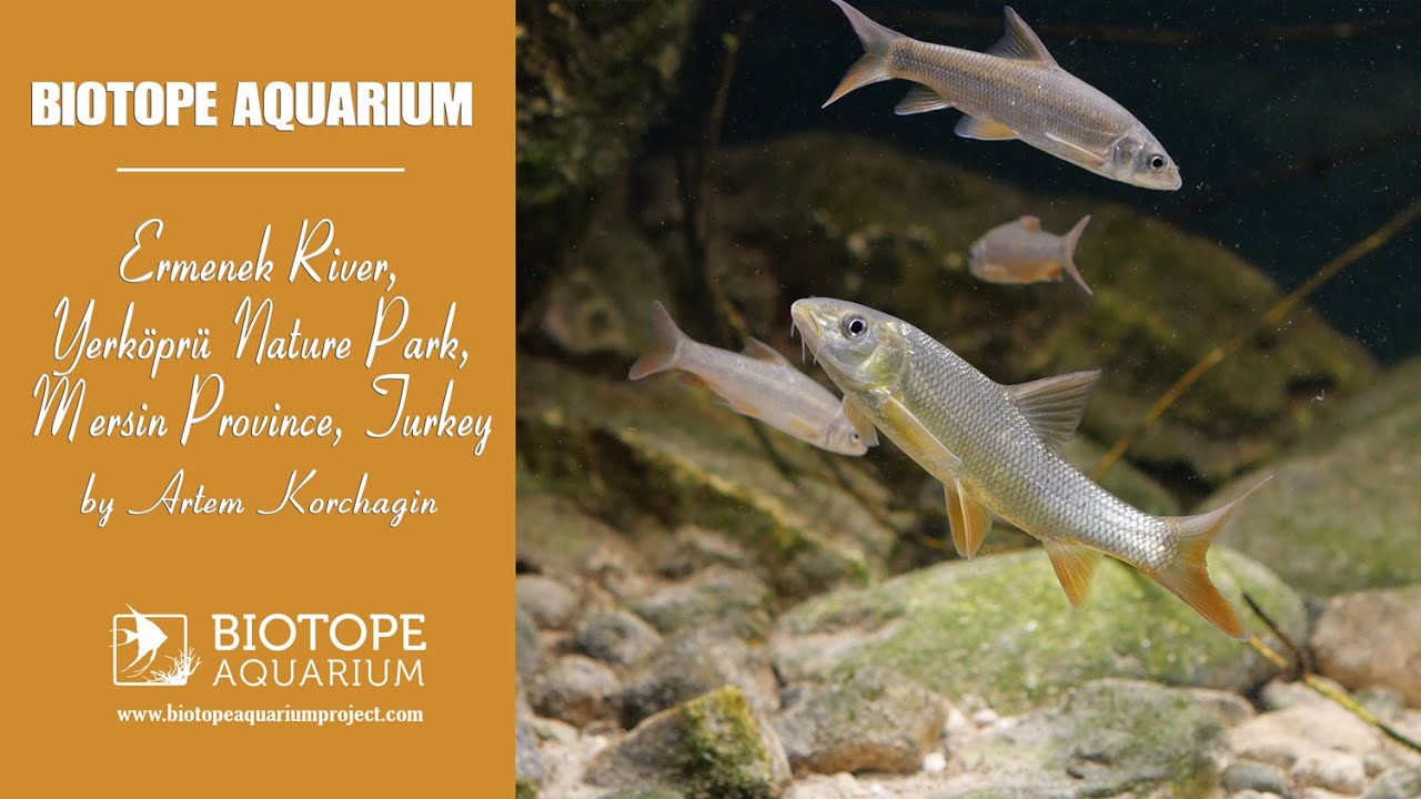
In my 500-liter aquarium, I have recreated a section that simulates the boundary between a deeper, faster-flowing part (the main channel) and a shallower, calmer coastal area (a micro-bay), where the current slows down and, depending on the bottom’s relief, often flows backward along the shore. Many fish are attracted to such zones, spending most of their time here – especially juveniles and young specimens – or visiting briefly.
Additionally, it’s logical and simple to reproduce such a zone in an aquarium with a standard circular water flow. The main feature of the terrain is the irregularly shaped boulders of various sizes – fragments of fallen cliffs (the river here flows through a deep, narrow gorge). The above-water parts of some boulders are covered with a specific plant community. The shallower areas are overgrown in places with reeds and, less frequently, sedges.
I was very impressed by the compact combination of a zone that is convenient for realistic imitation.
- GPS
- 36.5346222, 33.2320518
- Geographical region
- Western Asia
- Drainage Basin
- Mediterranean sea
- River catchment
- Goksu river
- Water body type
- River
- Water body name
- Ermenek
- Water body part
- Rapids
- Water body course
- Upper course
- Water body: tributary of
- River
- Tributary name
- Goksu
Videos above and below water