bin
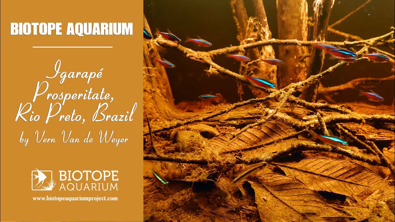
Igarapé Prosperitate, Rio Preto, Brazil
Brazil, Amazonas, Santa Isabel do Rio Negro
The igarapé Prosperitate is a tributary of the lower Rio Preto, a northern affluent of the Rio Negro, Brazil. The igarapé Prosperitate is a typical example of the countless small rain forest creeks of the Rio Negro region. The igarapé is located 12,5 km north-west off its junction with the Rio Negro.
- Submitted by
- Vern Van de Weyer
- Approved by
- Roberto Reis, Francesco Denitto & Donald C. Taphorn
- GPS
- -0.1630500, -64.1197205
- Geographical region
- South America
- Drainage Basin
- Rio Negro basin
- River catchment
- Rio Negro
- Water body type
- Igarapè
- Water body name
- Prosperitate
- Water body part
- River mouth
- Water body course
- Lower course
- Water body: tributary of
- Rio
- Tributary name
- Preto
Videos above and below water
Warning: Undefined variable $fish_parent in /home/biotopea/public_html/wp-content/themes/bap/content-bin.php on line 55
Water Chemistry
Water information
- Water type
- fresh-water
- Water color
- Black water
- Water transparency
- Medium
- Concentration of sediments
- Low
- Water temperature
- 22-24 in the shade and up to 29.5°c in the sunny parts °C
- Water flow/curent
- Slow
Chemical parameters
- pH
- 5
- Conductivity
- 70
- GH
- 20 mg/l
- dGH
- KH
- dKH
- Dissolved Oxygen
Substrate in nature
- Sand
- Beige
- Pebble/Gravel
- None
- Stone
- None
- Stone form
- Silt/Mud
- Brown
- Leaves
- Adundant
- Driftwood
- Many
- Submerged terrestrial vegetation
- no
Aquatic Biotope
- Date of collecting
- 1994
- Collecting area
- Small bay
- Water depth
- 1,0m
- Air temperature
- Sunlight
- Full sun
Environment
- Environment
- Untouched
- Surrounding area
The actual stream bed is flanked by broad belts of flood plains, and virtually the entire course is fully shaded by the surrounding vegetation, chiefly Ficus trees. Only the mouth, where during low water the final 30 meters of the forest stream broaden to form a lagoon some 5 meters in width, is exposed to sunlight. Upstream from its broad mouth, the creek splits into two branches. One falls dry during low water, only flowing during periods of normal or high water levels. The other branch maintains a width of 1.5 meters and a depth of 20 to 30 centimeters. The forest encompassing the igarapé Prosperitate consisted of various Ficus trees that measured about 8 meters in height. At the peak of the water height, they are submerged up to their crowns, up to about six meters.
- Underwater landscape
During this period of low water the igarapé mouth measured a maximum depth of 1.2 meters, with no more than 40 cm of water above the layer of leaf litter. Temperatures reach a maximum of 29.5°C. Upstream the water temperature is approximately 24°C, because the complete stream is in shade. All sections of the stream have a substrate of leaf litter several decimeters thick. The upper third of the leaf litter is relatively loose and interspersed with a multitude of branches. The entire watercourse and adjacent areas were scattered with numerous tree stumps.
Fish:
- Threats to ecology
No threats found.
Riparian zone
- Trees near the aquatic habitat
-
Many - Ficus
Bibliography
-
Cichlid atlas volume 1 - Page168-175;122-123; 160; 652-656; 1068-1073
by Uwe Romer
Comment by the expert
Roberto Reis: Good description of BIN, but one photo, no videos.
Francesco Denitto: Not many infos nor infographic material were given about the BIN. Just few basic ones.
Donald C. Taphorn: This tank has some of my favorite aquarium fishes. You provided good links to more details, so well done on that account.