bin

Low tide at Colleges Crossing Brisbane River, Queensland

Sponsored by

Australia, Queensland, Chuwar

The Brisbane river is a large river drainage located in South East Queensland Australia, it flows 344km from Brisbane River’s source which is located in the Great Dividing Range, east of Kingaroy. Colleges Crossing is roughly located about halfway from the source to the mouth of the river.

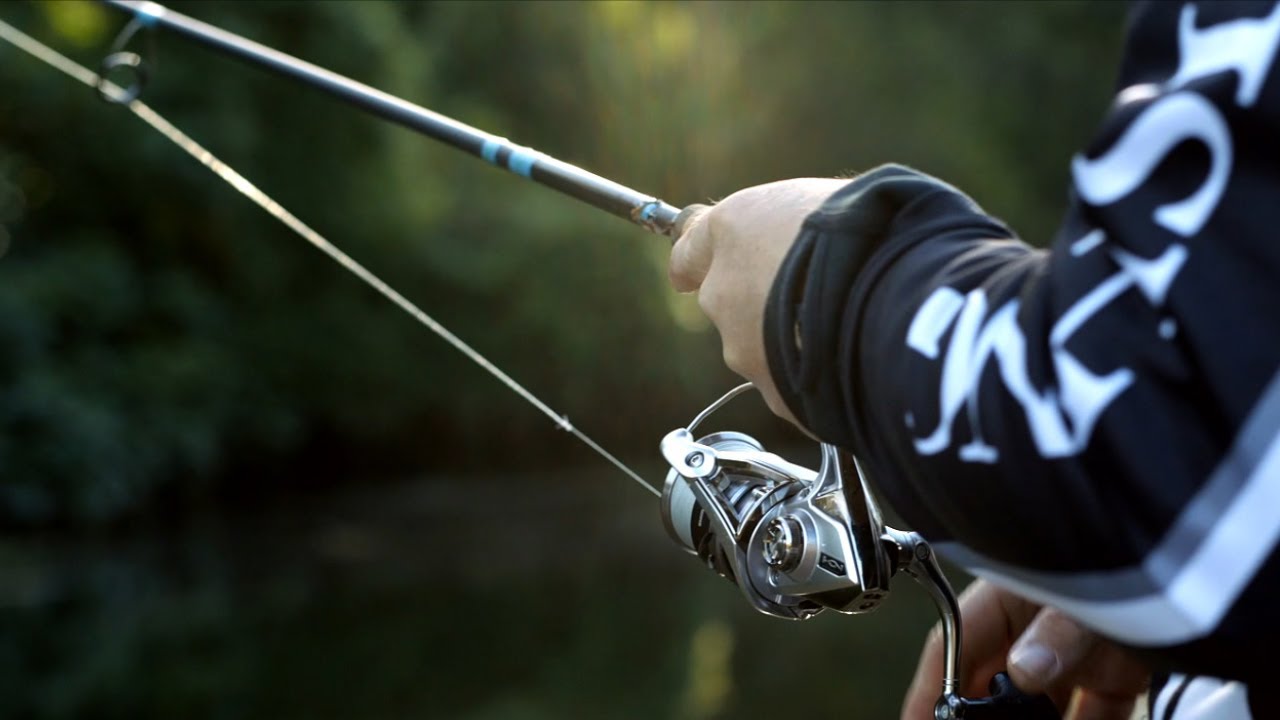
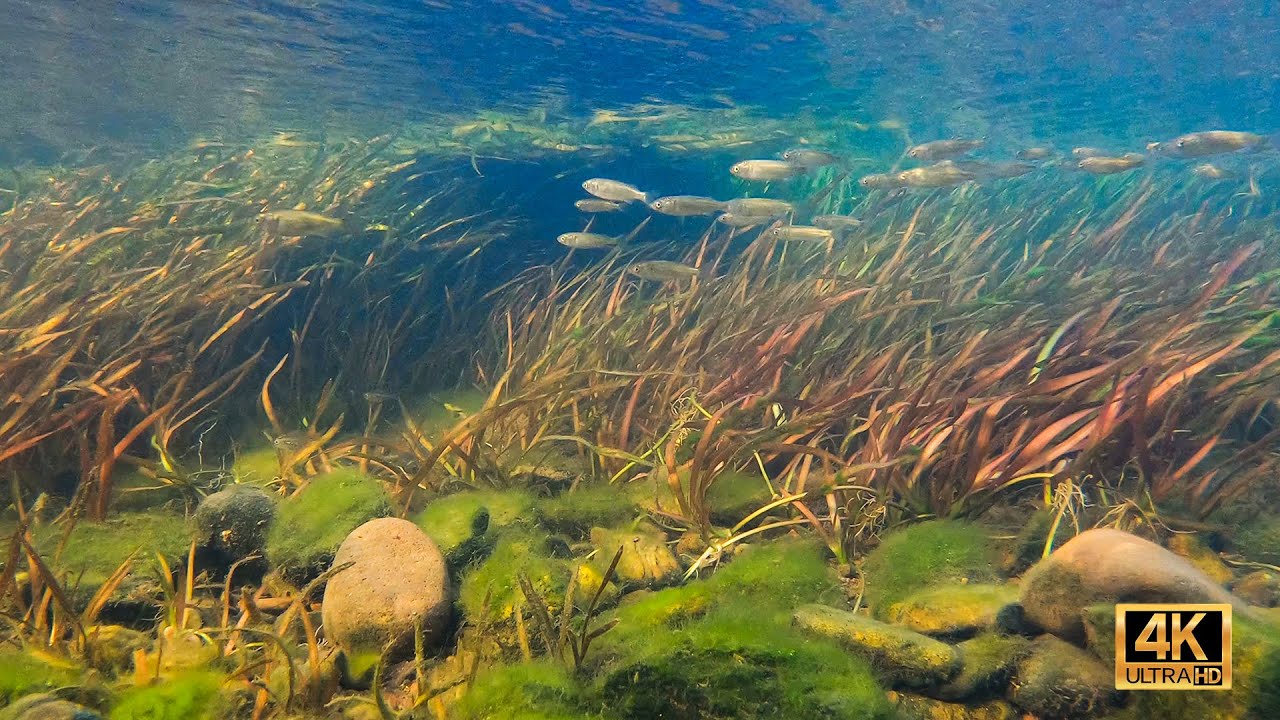
Located here is a park, known as Colleges Crossing Recreational Reserve, which is a popular picnic spot for both tourists and locals, and has been it since the early 1920s. The area is also known for it’s abundant aquatic life, and is also a popular fishing area.

College’s Crossing is named after George College one of the first settlers who bought a land on the north side of the Brisbane River.

Submitted by
David Nørholm
Approved by
Greg Martin & Peter Unmack
GPS
-27.5568371, 152.8021851
Geographical region
Oceania
Drainage Basin
Brisbane River
River catchment
Brisbane River
Water body type
River
Water body name
Colleges Crossing
Water body part
Channel
Water body course
Middle course
Water body: tributary of
Tributary name
Brisbane River

Videos above and below water

Water Chemistry

Water information

Water type
Fresh water
Water color
Clear water
Water transparency
Medium
Concentration of sediments
Medium
Water temperature
Very much depending on the tide, but about 23-24 °C
Water flow/curent
Slow

Chemical parameters

pH
8.0
Conductivity
380
GH
KH
Dissolved Oxygen
85 %

Substrate in nature

Sand
Beige
Pebble/Gravel
Mixed
Stone
Mixed
Stone form
Roundish
Silt/Mud
Beige
Leaves
Few
Driftwood
Many
Submerged terrestrial vegetation
Yes

Aquatic Biotope

Date of collecting
October 1, 2021
Collecting area
River bank
Water depth
0,5m
Air temperature
25 °C
Sunlight
Partial shade

Environment

Environment
Human settlements
Human settlements
Dispersed
Surrounding area

Now a days the area is dominated by human settlements in form of playground’s, cafe’s and BBQ areas. The area is used more for human recreation than aquatic habitats, but there’s still some of the old forrest and natural looking surroundings left.

Tree’s, grasses and stones are scattered across the riverbank, and at some times of the season there’s even small streams flowing down to the river.

Underwater landscape

The Range of substrate rock can vary in this biotope, but It mainly consists of heavy smooth river rock where the flow is fast to small pockets of fine sand and leaf litter where it is slow flowing. Most of the river in the area has a lot of structure consisting of large fallen hollows and branches of the local Eucalyptus, Casuarina, Callistemon, Melaleuca trees that surround the river.

At some places the riverbank is flat and sandy, but other places consists of a plateau with plants, roots and branches hanging down from the above vegetation.

Fishes:

  • Melanotaenia duboulayi (Melanotaeniidae)
  • Hypseleotris compressa (Eleotridae)
  • Craterocephalus stercusmuscarum (Atherinidae)
  • Ambassis agassizii (Ambassidae)
  • Hypseleotris galii (Eleotridae)
  • Acanthopagrus australis (Sparidae)
  • Pseudomugil signifer (Pseudomugilidae)
  • Gerres subfasciatus (Gerreidae)
  • Redigobius bikolanus (Gobiidae)
  • Redigobius balteatus (Gobiidae)
  • Pseudomugil gertrudae (Pseudomugilidae)
  • Neoceratodus forsteri (Neoceratodontidae)
  • Tandanus tandanus (Plotosidae)

Crustaceans

  • Paratya australiensis (Atyidae)

Aquatic plants:

  • Crinum pedunculatum (Amaryllidaceae)
  • Ludwigia repens (Onagraceae)
  • Ottelia alismoides (Hydrocharitaceae)
  • Ceratophyllum demersum (Ceratophyllaceae)
  • Valisneria nana (Hydrocharitaceae)
  • Azolla pinnata (Salviniaceae)
  • Nymphoides indica (Menyanthaceae )
  • Hydrocotyle tripartita (Araliaceae)

Wetland plants:

  • Persicaria decipiens (Polygonaceae)
  • Juncus usitatus (Juncaceae)
Threats to ecology

This area of the river has gone through a lot of changes in recent years it has gone through 3 major floods the last being one of the biggest in 2011 where the water levels rose several metres at Colleges Crossing and devastated the region.

It has now been turned into a recreational reserve for birds and aquatic species in the area of the biotope, but still faces dangers from development and pollution in other areas, it flows through two of Queensland’s major city’s Ipswich and Brisbane and is a major port at its mouth for the region and has been dammed. It is also home to one of Australia’s prehistoric fish the Queensland lungfish (Neoceratodus forsteri) which could be threatened by the Mozambique mouth brooder, or tilapia, it has been declared a noxious and threatening alien species to the lungfish in Queensland.

As previously mentioned, human activity is also pronounced in the area. Tourists and other visitors leave there marks on the area.

Riparian zone

Trees near the aquatic habitat
- Eucalyptus sp. (Myrtaceae)
Trees near the aquatic habitat
- Casuarina (Casuarinaceae)
Trees near the aquatic habitat
- Melaleuca (Myrtaceae)