bin
Floodplain Pond, Río Tomo, Vichada, Colombia
Colombia, Vichada, Puerto Carreño
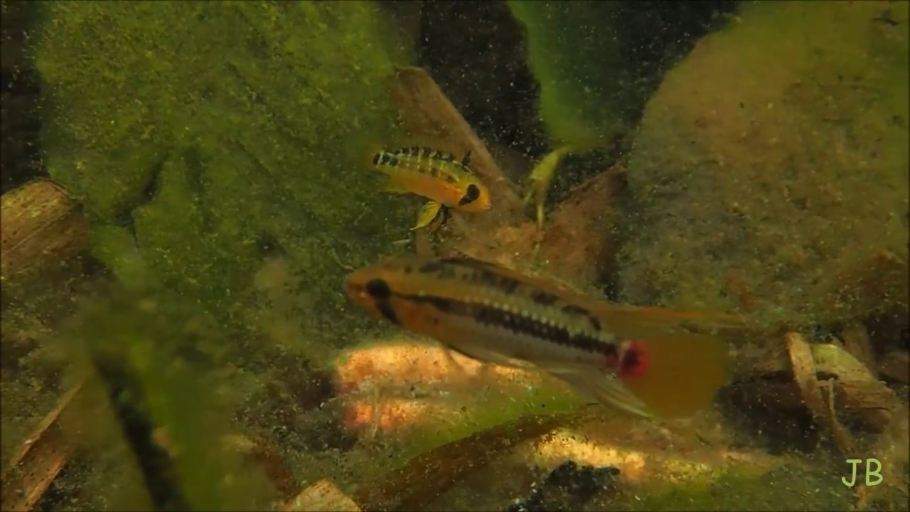
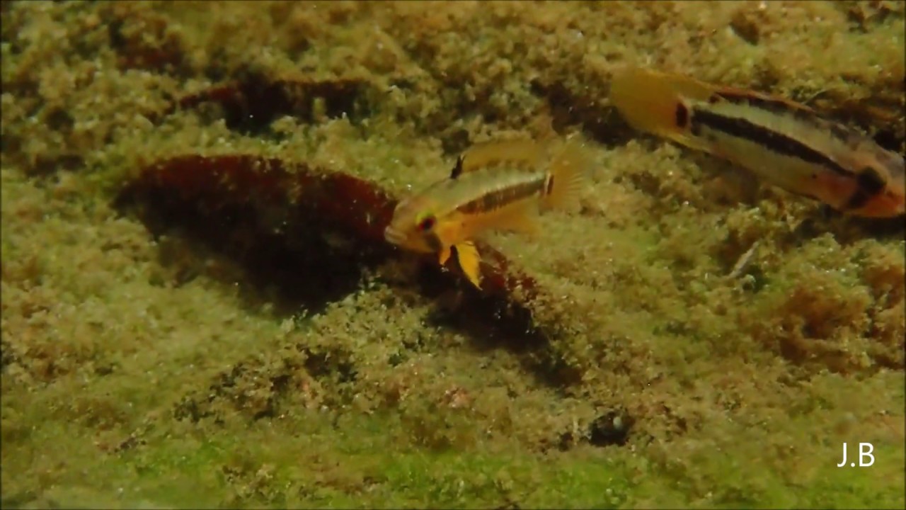
It is a simulation of one of the small ponds formed as a result of the flooding of the Orinoco River system in the state of Vichada. These ponds are also the habitat of Apistogramma hongsloi.
- Submitted by
- Arif Hikmet Başeğmez
- Approved by
- Roberto E. Reis, Pablo C. Lehmann and Flávio Lima
- GPS
- 5.5144162, -68.3265991
- Geographical region
- South America
- Drainage Basin
- Río Orinoco
- River catchment
- Río Tomo
- Water body type
- Wetland
- Water body name
- Vichada flood pond
- Water body part
- Flood plain
- Water body course
- Water body: tributary of
- Tributary name
Videos above and below water
Warning: Undefined variable $fish_parent in /home/biotopea/public_html/wp-content/themes/bap/content-bin.php on line 55
Water Chemistry
Water information
- Water type
- fresh-water
- Water color
- Mixed water
- Water transparency
- Medium
- Concentration of sediments
- Medium
- Water temperature
- 26 °C
- Water flow/curent
- None
Chemical parameters
- pH
- 6.0
- Conductivity
- 60
- GH
- 2 mg/l
- dGH
- KH
- 0
- dKH
- Dissolved Oxygen
Substrate in nature
- Sand
- Grey
- Pebble/Gravel
- None
- Stone
- None
- Stone form
- Silt/Mud
- Leaves
- Driftwood
- Few
- Submerged terrestrial vegetation
- Yes
Aquatic Biotope
- Date of collecting
- Collecting area
- Water depth
- Air temperature
- Sunlight
Environment
- Environment
- Affected by human activity
- Affected by human activity
- Agriculture
- Agriculture
- Little
- Surrounding area
Río Orinoco is a major river of South America that flows in a giant arc for some 2.740 km from its source in the Guiana Highlands to its mouth on the Atlantic Ocean. Throughout most of its course it flows through Venezuela, except for a section that forms part of the frontier between Venezuela and Colombia. The name Orinoco is derived from Warao (Guarauno) words meaning “a place to paddle”— i.e., a navigable place.
The Orinoco and its tributaries constitute the northernmost of South America’s four major river systems. Bordered by the Andes Mountains to the west and the north, the Guiana Highlands to the east, and the Amazon watershed to the south, the river basin covers an area of about 948.000km². It encompasses approximately 4/5 of Venezuela and 1/4 of Colombia.
For most of its length, the Orinoco flows through impenetrable rain forest or through the vast grassland (savanna) region of the llanos (plains), which occupies 3/5 of the Orinoco basin north of the Guaviare River and west of the lower Orinoco River and the Guiana Highlands. The savanna was given its name by the Spaniards in the 16th century and long has been used as a vast cattle range. Since the 1930s this region has been developing into one of the most industrialized areas of South America.
- Underwater landscape
The region is filled with reeds and wetland ponds due to the floods of the Orinoco river and its tributaries. The submerged botanical fragments are home to the hongsloi family living here. The ground is covered with dry leaves of reeds, branches and leaves, as well as plants such as Helanthium tenellum and Eleocharis sp. The water is soft and acidic as well as slightly stained with tannin.
Fish:
- Apistogramma hongsloi (Cichlidae)
Aquatic plant:
- Pontederia crassipes (Pontederiaceae)
- Eleocharis sp. (Cyperaceae)
- Helanthium tenellum (Alismataceae)
- Threats to ecology
Compared to many of the world’s river systems, the Orinoco basin is relatively intact.
But this may not last for long as the river and its surrounding areas are threatened by pollution and mining activities.
Large areas of the flooded forests have been cleared for agriculture and cattle ranching. And large dams planned for several major tributaries will destroy water flows that support the region’s unique aquatic life.
These beautiful regions inspire me as I love the Apistogramma hongsloi.