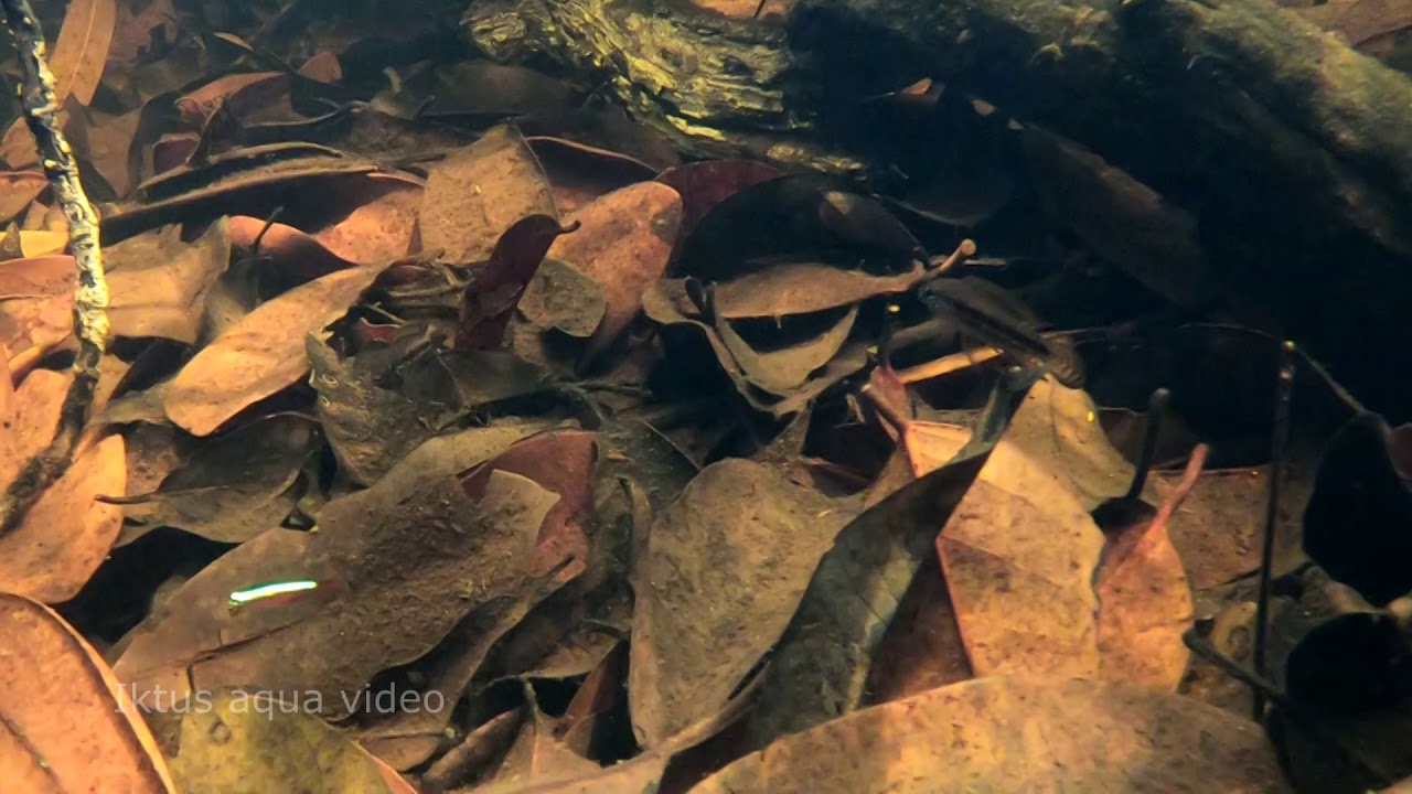
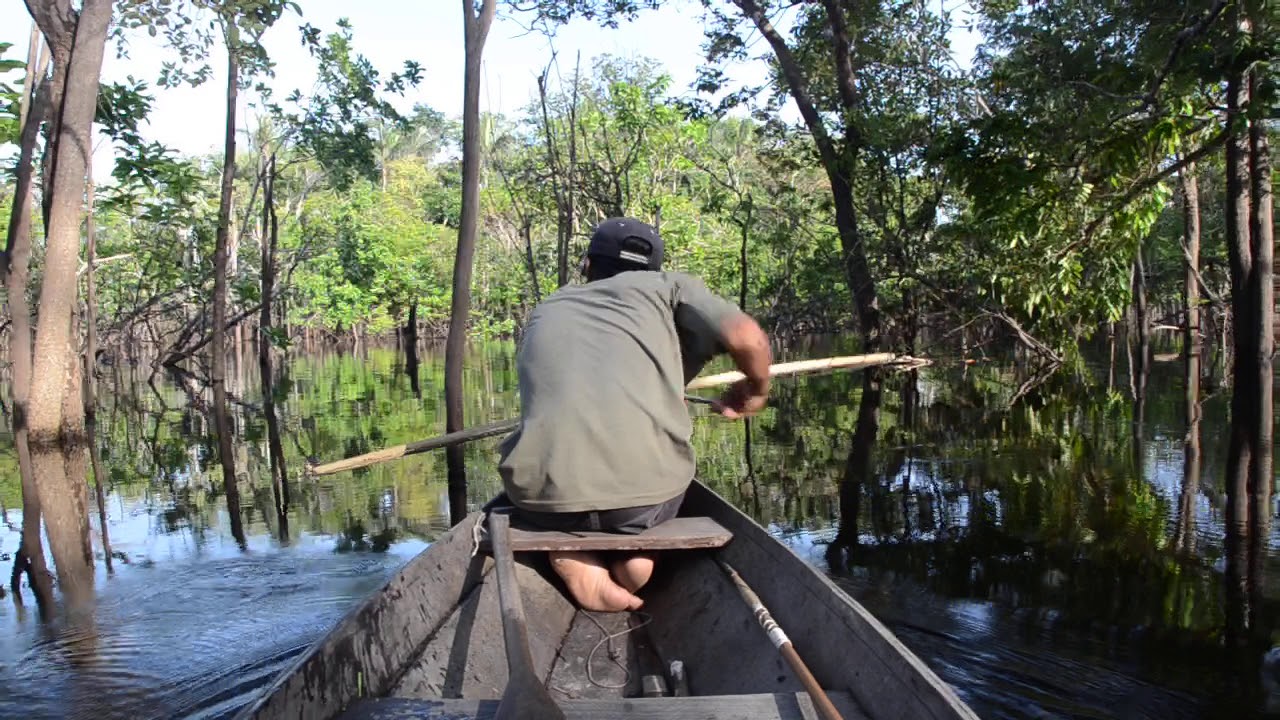
When I saw the impressive video on which this biotope is based, I began an investigation to locate the author.
It wasn’t easy, because the author of the YouTube video was “Maratecoara” and did not give any further clues about a possible real name.
I needed to know the exact coordinates of the video recording to investigate further and be more specific, and “Maratecoara” was not a real name but rather a pseudonym he used to sign his YouTube videos.
With that name there was no way to contact him; the internet did not provide reliable leads. In fact, the first attempts led to a ridiculous result, because when I thought I had found the right person (two clues led me to him) and I was able to tell him the story, his response was a big laugh.
Apparently, he was a radio host, as he replied:
“I have to tell this on my radio show.”
I was pretty desperate and stuck, so I decided to show the video to a friend who has been specializing in biotope aquariums for many years.
“I know him, but I haven’t heard from him in years,” he replied.
My eyes widened, as he was the only one who could at least give me his name and nationality.
I kept investigating and, boom, I found him.
I won’t reveal his identity because this person signs with the name “Maratecoara”; it must remain that way. By email he kindly provided me with the exact coordinates of the “Igapó of the Rio Demini.”
I am very grateful to both him and my friend Nico Luchoro; without them I would not have been able to continue with the research.
0°41’31.94″ S, 62°54’13.52″ W
This point is located directly north of Lago Maqui, on the middle basin of the Rio Demini, in the state of Amazonas, Brazil. It is located about 32 km north of Barcelos, in a truly remote area accessible only by river.
A jungle area where the igapó connects with meanders, lagoons, and secondary branches of the Rio Demini, which feed the wetlands of this region.
The Rio Demini is a fairly large river encompassing several biotopes. It can reach 200 m wide and is surrounded by sandbanks.
In this biotope that I recreate, we will not be interested in the main channel, composed mainly of enormous fish not suitable for our aquariums, and other smaller ones which we aquarists do keep, such as Symphysodon discus Heckel, Pterophyllum leopoldi, Leptodoras linnelli, Dicrossus filamentosus or the famous loricariids L114 and L169.
In the igapós, the main fish found are Apistogramma and tetras, as well as hatchetfish and pencilfish, as has been documented in several captures during expeditions such as those of Project Piaba in various igapós of the Rio Demini, or as we can also observe in Maratecoara’s YouTube video.
In general, the pH is very acidic, ranging between 3.96 and 5.26, and a conductivity of about 15 microsiemens per centimeter.
This region is a mixture of lowland floodplain forests and tropical rainforest streams, with seasonal floodplains, swamps, and lakes.
The rainforest in this area is mostly unaltered and uninhabited by humans.
The floodplain ecosystem is divided into: high floodplain and low floodplain. The high floodplain follows the riverbanks, has fertile soils, and is dense and very closed, with trees averaging 20 m in height. It is less diverse compared to terra firme forest, as species need mechanisms to withstand the seasonal rhythm of flooding, but there is still a great diversity of fauna.
Common in the high floodplain are tree species such as Ceiba, rubber tree (Hevea brasiliensis), and Andiroba. Herbivorous animals such as the black caiman, whose presence is closely linked to seasonal changes, thrive during the rainy season when the water level rises.
In addition to them, mammals also make their home in the floodplain, including jaguars, which have developed a unique way of life to adapt to the rhythm of the rivers.
On the other hand, low-lying floodplains are generated in areas where water stagnates after river floods and can remain flooded for more than half the year.
Some examples of plant species found in low-lying alluvial plains include aninga (Montrichardia arborescens), arumã (Ischnosiphon polyphyllus), and palm trees such as buriti (Mauritia flexuosa), açaí (Euterpe oleracea in the lower Amazon, or Euterpe precatoria in the central Amazon), jauari (Astrocaryum jauari), jurubatí (Raphia taedigera), and palmarito (Leopoldinia pulchra), where toucans feed on the fruits of these palms. On the trees, epiphytic bromeliads such as Aechmea mertensii and orchids such as Cattleya violacea can be seen growing.
Whenever possible, I refer to flora and fauna by their scientific names, but also by the names used locally to describe them.
There is a wise saying in Old Spanish that I love:
“Allá donde vayas, haz lo que vieres.”
Which translated into English would be:
“When in Rome, do as the Romans do.”
As for the fauna, species such as the Amazonian manatee, the giant otter, and a wide variety of fish such as tucunaré (Cichla spp.), highly prized for sport fishing, are not very common in the igapós, but there are records of them.
Most of the fauna in floodplains migrates between the floodplains and the igapós.
Terrestrial Vegetation:
- Piranhea trifoliata (Picrodendraceae)
- Montrichardia arborescens (Araceae)
- Mauritia flexuosa (Arecaceae)
- Euterpe precatoria (Arecaceae)
- Raphia taedigera (Arecaceae)
- Astrocaryum jauari (Arecaceae)
- Leopoldinia pulchra (Arecaceae)
- Symphonia globulifera (Clusiaceae)
- Virola surinamensis (Myristicaceae)
- Ischnosiphon polyphyllus (Marantaceae)
- Macrolobium acaciifolium (Fabaceae)
- Aldina latifolia (Fabaceae)
- Carapa guianensis (Meliaceae)
- Eschweilera coriacea (Lecythidaceae)
- Eschweilera tenuifolia (Lecythidaceae)
The impact of the Amazon rainforest on the global climate is proportional to its size.
The ecosystem services provided by this biome, in other words, the benefits that nature provides to society, are essential for maintaining climate balance and supporting many human activities.
Processes such as evaporation and transpiration within the forest contribute to maintaining seasonal rainfall patterns, which are essential for agriculture.
Furthermore, the Amazon rainforest functions as a massive carbon store, with carbon being stored in plant tissues and soils. This natural reservoir is threatened by deforestation, especially when it is followed by burning.
Amazon deforestation releases approximately 200 million tonnes of carbon into the atmosphere every year.
The release of this enormous carbon reserve disrupts the greenhouse gas balance and, consequently, affects climate conditions across the planet.
For this reason, preserving the standing rainforest must be a priority, not only for the countries that share the Amazon biome but for the entire world.
The loss of forests also affects other ecosystems that depend on ecological balance and causes a series of environmental changes worldwide. Studies based on satellite data have shown that forest loss in the Amazon can increase surface temperatures by up to 3 °C, shorten the rainy season, and alter the regional climate balance.
A clear example is the case of the ipê tree (Handroanthus spp.), which is more common in várzea forests than in igapós and provides one of the most valuable timbers in the Brazilian Amazon.
Hardy, rare, and highly profitable on international markets, ipê trees are a prime example of the impact of illegal logging in the Brazilian Amazon. Wherever these trees occur, deforestation often follows.
There are seven species of ipê in the Brazilian Amazon. Their timber is widely used for flooring and decking because of its exceptional hardness and resistance to fungi, insects, and fire.
Ipê populations are particularly vulnerable because illegal loggers go to great lengths to locate and harvest these valuable trees. Historically, Europe, the United States, and Canada have been the largest markets for ipê timber.
Between 2017 and 2021, at least 525 million kilograms of ipê wood were exported from Brazil, primarily to these three markets. However, increasing international pressure to combat illegal and unsustainable logging has reduced demand in recent years. As a result, Brazil’s domestic market has expanded, taking advantage of the increased supply.
During the COVID-19 pandemic, illegal sales of ipê timber increased by approximately 15%, particularly for construction in southern and southeastern Brazil.
If left unprotected, ipê populations could disappear from many areas. These trees require 80 to 100 years to reach maturity and naturally occur at very low densities. As a result, loggers often clear large areas of forest to obtain only a few individuals.
The expression “ipê mafias” has even been used to describe criminal groups involved in illegal logging in the Brazilian Amazon, since ipê provides some of the highest financial returns. Fraudulent logging permits frequently overestimate the number of ipê trees within authorised concessions, allowing illegally harvested timber from protected areas to be laundered into the legal market while distancing exporters from the original criminal activity.
Fortunately, during the past two years, deforestation in the Brazilian Amazon has declined significantly thanks to the environmental policies introduced by President Luiz Inácio Lula da Silva’s government and the increased use of satellite monitoring to combat illegal logging. Nevertheless, major threats remain, including forest fires, agricultural expansion, cattle ranching, and illegal mining.
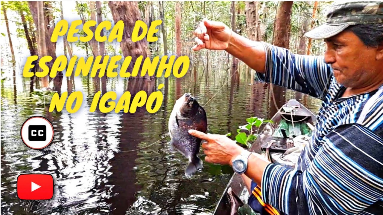
In this context, and specifically regarding the igapó of the Rio Demini biotope near Barcelos, the piabeiros – the fishermen who depend on the ornamental fish trade and represent about 60% of the local population – play a fundamental role in protecting aquatic ecosystems and preventing deforestation.
They are the first to understand that preserving rivers, lakes, wetlands, and igapós is essential. Without healthy ecosystems, they would lose both their jobs and their livelihoods. Protecting these flooded forests is the most sustainable way to ensure that future generations can continue harvesting ornamental fish responsibly.
By keeping these igapós intact, they can continue the sustainable capture of highly sought-after species such as the cardinal tetra (Paracheirodon axelrodi), the most important ornamental fish collected in the region and exported to aquarists around the world.
It is ironic that those of us who keep ornamental fish in our homes are, in many cases, directly contributing to the conservation of these habitats, while we are often accused of doing exactly the opposite.
I believe we all agree that fish belong in their natural habitat. However, in today’s world, where development continues to expand into previously untouched environments, sustainable economic activities that depend on healthy ecosystems may become one of the strongest incentives for protecting them.
Apart from deforestation, intentional fires have devastated vast areas of the Brazilian Amazon.
During Jair Bolsonaro’s administration, widespread burning was tolerated in order to clear land for agriculture. Scientists estimated that, between 2010 and 2019, the Brazilian Amazon released approximately 20% more carbon dioxide than it absorbed.
A balance between nature and human development is essential. Destroying the Amazon ultimately means destroying part of humanity’s future.
One concern among scientists is that climate change could directly affect the ecological balance of the Amazon.
A NASA study found that phosphorus-rich dust travels from the Sahara Desert to the Amazon, with an average of approximately 22,000 tonnes deposited each year. This figure closely matches the amount of phosphorus lost annually from the rainforest through heavy rainfall and flooding.
In other words, analyses based on seven years of data collected by the CALIPSO environmental satellite revealed that the Amazon ecosystem depends on Saharan dust, which is rich in phosphorus and iron, to compensate for the continuous loss of nutrients.
At the same time, the study showed that this phosphorus represents only about 0.08% of the 27.7 million tonnes of Saharan dust deposited in the Amazon each year after travelling nearly 8,000km.
Almost nothing.
“Dust will affect climate, and climate will affect dust,” reflected Hongbin Yu, co-author of the study. His work reminds us that we live on a planet where everything is interconnected, and that what happens on one continent can have profound consequences for another.
According to the study, the amount of Saharan dust crossing the Atlantic each year depends largely on rainfall in the Sahel, the semi-arid belt bordering the southern edge of the Sahara. The more it rains there, the less dust is transported from Africa to South America.
Another threat is the construction of hydroelectric dams, such as the Balbina Dam, which flooded approximately 312.900 hectares of Amazon rainforest, creating an artificial archipelago of more than 3.500 islands, most of them smaller than 100 hectares.
This caused widespread biodiversity loss throughout the flooded area.
Although the igapó described in this work is located in a remote region, it is also essential to prevent water pollution caused by artisanal mining, particularly gold mining, which introduces mercury and other toxic contaminants into rivers.
Infrastructure development and increasing accessibility must also be carefully managed. Roads, mining camps, and even tourist facilities can fragment habitats and threaten the integrity of these ecosystems.
I would also like to discuss a fashionable “superfood” that is creating new environmental challenges in the Amazon.
The rapid expansion of açaí (Euterpe oleracea) cultivation in Brazil is reducing biodiversity.
The environmental impact of poorly managed monocultures has become a classic example of how agricultural expansion can damage natural ecosystems. Similar concerns have been raised for crops such as avocado, quinoa, and coconut, where growing global demand has encouraged unsustainable production practices.
The problem is not the foods themselves, but the way they are cultivated, produced, and marketed. Deforestation, land conversion, excessive water use, fertilizers, pesticides, and labour exploitation are the real threats.
One of the most recent – and still relatively little studied – examples is açaí. Once a traditional Amazonian food, it has become a worldwide phenomenon thanks to marketing campaigns that often highlight selected scientific studies describing its potential health benefits.
Whether or not açaí deserves to be considered a “superfood,” it is clear that the rapid expansion of Euterpe oleracea plantations in the Amazon estuary is altering natural ecosystems and reducing biological diversity.
After studying 47 forest plots in the Amazon estuary, the research team led by Madson Freitas, from the Department of Botany at the Federal University of Pernambuco, reached four main conclusions:
- The intensification of açaí cultivation completely changes the structure of estuarine forests.
- Forests dominated by dense açaí plantations show a significant reduction in understory, canopy, and emergent tree diversity.
- Current Brazilian legislation regulating the intensification of açaí cultivation does not adequately protect forest integrity or biodiversity.
- Although açaí cultivation provides important economic opportunities for local communities, it can also become a serious threat to Amazonian estuarine forests if not properly managed.
Açaí is rich in antioxidants, fibre, and energy. However, its growing popularity should be accompanied by sustainable production practices that protect biodiversity rather than sacrifice it. We should avoid being influenced by marketing trends alone.
The Amazon rainforest will thank us.
Very different is the case of the seringueira, or rubber tree (Hevea brasiliensis), often called the “guardian of the forest.” Unlike valuable timber species, it provides economic benefits without the need to cut it down, making it an excellent example of sustainable use that helps keep the forest standing.
The rubber tree is native to the tropical rainforests of Brazil, Venezuela, Colombia, Ecuador, Peru, and Bolivia.
Fortunately, the brutal practices associated with the Rubber Boom now belong to history. That period led to severe abuses and the deaths of tens of thousands of people, particularly Indigenous communities in regions such as Putumayo, on the border between Peru and Colombia.
Rubber trees are typically found in humid lowland forests, wetlands, riparian habitats, forest clearings, and disturbed areas, and are generally more common in várzea forests than in igapós.
They are fast-growing trees that can reach heights of 30 to 40 metres and live for around 100 years. Their best-known characteristic is the white, milky latex that flows when a narrow strip of bark is carefully cut during the tapping process. This method does not kill the tree and allows latex to be harvested repeatedly while keeping the forest intact. Even today, latex remains an important source of income for many Indigenous and traditional forest communities.
For this reason, the rubber tree has become known as the “guardian of the forest.” Rubber tappers have historically protected both the trees and the forests on which their livelihoods depend.
Deforestation not only harms the species that depend on the forest, but also the people whose livelihoods rely on the sustainable use of its natural resources. Many Indigenous communities depend on these resources to support their families and preserve their traditional way of life.
Chico Mendes, a Brazilian rubber tapper, became internationally known for opposing the indiscriminate clearing of the Amazon rainforest for cattle ranching. Thanks to his efforts, together with those of rural workers’ unions, the Brazilian government created important Extractive Reserves, where local communities can sustainably harvest forest products such as natural rubber.
Natural rubber remains an important raw material used in the manufacture of tyres, medical equipment, and many other products. It is also used to produce “vegetable leather” for handicrafts, generating income for local communities while encouraging a relationship of respect and care for the forest.
The seringueira represents a balance between the economic development of forest communities and the preservation of the Amazon rainforest.
In 1988, Chico Mendes was murdered at his home by ranchers Darcy and Darly Alves, who were later convicted and sentenced to 19 years in prison, although they served only six years.
This injustice only strengthened Chico Mendes’ legacy. Today, he is remembered throughout Brazil as a martyr and one of the greatest symbols of the struggle to defend the Amazon rainforest.
His legacy deserves to be carried forward so that his values, determination, and vision continue to inspire future generations.
Yanomami Genocide
The Yanomami are the largest Indigenous people living in the Amazon rainforest. Their territory extends across northern Brazil and southern Venezuela, and their total population is estimated at around 45,000 people.
Their first sustained contact with outsiders began during the 1940s, when the Brazilian government sent workers to survey the border with Venezuela. This contact introduced diseases such as measles and influenza, causing devastating epidemics among communities with no natural immunity.
In the early 1970s, Brazil’s military government decided to build a highway across the Amazon and along the country’s northern border. Without warning, bulldozers entered Yanomami territory. Entire communities, including Opiktheri, were devastated, while many people died from diseases introduced by the construction crews.
During the 1980s, the Yanomami suffered another tragedy when almost 40,000 Brazilian gold miners invaded their territory. Many Indigenous people were killed, villages were destroyed, and diseases spread once again. It is estimated that about 20% of the Yanomami population died within only seven years.
After a long international campaign led by Davi Kopenawa, Yanomami Indigenous Land was officially recognized and demarcated in Brazil in 1992, and most illegal miners were expelled.
However, in 1993, some miners returned and attacked the community of Haximu, killing 16 Yanomami, including children. This massacre remains one of the darkest chapters in the history of Indigenous rights in Brazil.
The Yanomami live in large communal houses known as shabonos, some of which accommodate up to 400 people. Each family has its own fireplace, where they cook, gather, and sleep in hammocks suspended nearby.
Their society is based on strong principles of equality and cooperation. They hunt, fish, and cultivate the forest while maintaining a close relationship with nature.
They also possess extraordinary botanical knowledge, using nearly 500 plant species for food, medicine, and construction.
Despite this, their way of life continues to be threatened by thousands of illegal garimpeiros (gold miners), who invade Yanomami territory, spread diseases, pollute rivers with mercury, destroy forests, and contaminate fish stocks.
Deforestation is also advancing along the eastern border of their territory through cattle ranching and land grabbing. At the same time, healthcare remains inadequate, particularly in the Venezuelan part of Yanomami territory.
During Jair Bolsonaro’s presidency, the situation deteriorated further as illegal mining expanded significantly within Yanomami Indigenous Land. Deforestation, mercury contamination, violence, hunger, and exploitation increased dramatically, while many Indigenous women suffered sexual violence and some men were forced to work in illegal mining activities.
In January 2023, President Luiz Inácio Lula da Silva declared a public health emergency after learning that more than 570 Yanomami children under the age of five had died in recent years.
After visiting the region, Lula stated:
“More than a humanitarian crisis, what I saw in Roraima was a genocide, a premeditated crime against the Yanomami committed by a government insensitive to the suffering of the Brazilian people.”
His government ordered the removal of illegal miners and began providing emergency medical assistance by air to isolated communities.
In areas devastated by illegal mining, wildlife has largely disappeared, leaving mosquito populations to proliferate. With fewer wild animals available, mosquitoes feed more frequently on humans, contributing to the spread of malaria, which has become closely associated with illegal mining activities throughout the Brazilian Amazon.
The Rio Demini rises in the mountains near the Brazilian border with Venezuela and flows through the central part of the Yanomami Indigenous Land. It then winds around the Serra do Aracá before joining the Rio Negro near the town of Barcelos, in the state of Amazonas.
Its winding course and numerous rapids form the route used by the Yanomami when travelling to Barcelos to access government income support programmes. Along the Rio Demini lies the community of Maxokapiu, where the effects of these programmes on Indigenous communities can be clearly observed.
The situation has improved, but it is still far from ideal. Although these social programmes have produced positive results in many parts of Brazil, the way they are implemented in Yanomami territory often creates new difficulties instead of solving existing ones.
The journey from Maxokapiu to Barcelos takes about four days by river, with families sleeping in the rainforest along the way. Entire families travel together in small aluminium boats. Mothers make this difficult journey to access maternity benefits and the Bolsa Família programme.
For many Yanomami families, government cash transfer programmes have become their main source of income, allowing them to purchase items that greatly improve daily life, such as axes, machetes, flashlights, batteries, cooking pots, fabrics, and other essential supplies.
However, reaching the city is an exhausting journey. It begins on rivers the Yanomami know well and ends in the unfamiliar world of urban bureaucracy. During the dry season, low water levels often force travellers to push their boats across exposed rocks. During the rainy season, heavy rain, wind, and cold make the journey equally difficult.
By the time they reach Barcelos, they must face a new challenge: obtaining the documents required to access government assistance. For people who do not speak Portuguese fluently or who have little experience with administrative procedures, these bureaucratic requirements become major obstacles.
Living in the city is also expensive. Unlike the rainforest, food and shelter are not freely available. Many families are forced to pay simply to camp on private land while waiting for paperwork to be completed.
As the days pass, food and accommodation costs consume much of the money they have travelled so far to obtain. By the time they purchase fuel for the return journey, many families have little or nothing left.
When their money runs out, some are forced into debt and leave their bank cards and PIN numbers with local merchants, creating opportunities for fraud and exploitation.
The return journey is even longer, often taking six days against the current. Much of the food purchased in the city is consumed during the trip or spoiled by heat and humidity before reaching home.
After so much effort, many families return to their communities with very little. Some bring processed or ultra-processed foods of limited nutritional value, while only a few are able to purchase tools, sandals, clothing, or other useful items.
Many arrive home exhausted, thinner, sunburned, and sometimes seriously ill after spending days in unhealthy conditions without adequate sanitation, clean water, or proper medical care.
In this context, it is difficult to regard the Bolsa Família programme alone as a complete solution for communities that have suffered years of violence, displacement, and neglect.
Meanwhile, illegal mining continues in some areas despite government efforts, causing further destruction of forests and rivers.
Much more remains to be done. Greater security is needed to protect Indigenous communities from armed illegal miners, healthcare services must continue to improve through rapid access to remote villages, and degraded forests require restoration. Humanitarian assistance – including food, seeds, tools, and medical supplies – remains essential if the Yanomami are to recover from decades of hardship.
On issues such as these, neutrality is difficult. Remaining silent risks favouring those responsible for the destruction.
Let us raise our voices for peace, justice, and hope for the Yanomami people.