bin

Puddles, Malini River, Kotdwar, Uttarakhand, India

Sponsored by

India, Kanvasharam Uttarakhand, Kotdwar

The Malini River originates in the Shivalika range of Uttarakhand and flows through both Uttarakhand and Uttar Pradesh before joining the Ganga. It is a relatively short, non-perennial river. The Malini River is also known as the Ramganga.

Origin and flow: The Malini River begins in the Shivalika range of Uttarakhand. It then flows through the districts of Pauri Garhwal, Kotdwar, and Bijnor before merging with the Ganga.

Catchment area: The river’s catchment area is roughly 400km².

Length: It covers about 140-150km.

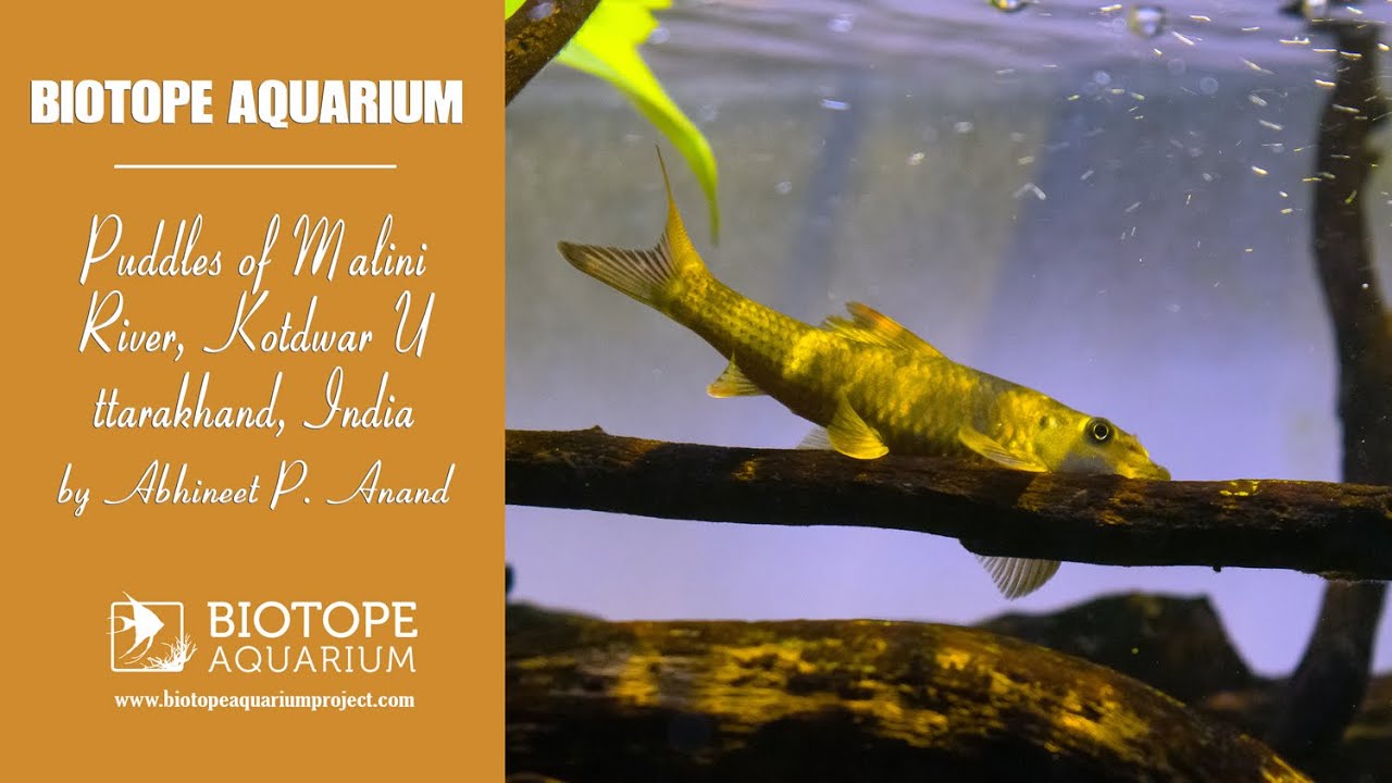
Non-perennial nature: The Malini is a non-perennial river, meaning its flow is not continuous throughout the year. Post rainy season and pre winters (October-November) the water level near Karnasharam, Uttarakhand, drops significantly thus, creating several dissected streams and small pools that traps several fishes.

The area in Uttarakhand is prone to heavy landslides during monsoon which affect the regular change in size and shape of river.

Submitted by
Abhineet Prakash Anand
Approved by
Hans-Georg Evers & Friedrich Bitter
GPS
29.8192005, 78.4761963
Geographical region
Southern Asia
Drainage Basin
Ganga
River catchment
Ganga river
Water body type
Puddle
Water body name
Puddles of dissected streams
Water body part
Pool
Water body course
Headwaters
Water body: tributary of
Puddle
Tributary name
Malini river (Ramganga)

Videos above and below water


Warning: Undefined variable $fish_parent in /home/biotopea/public_html/wp-content/themes/bap/content-bin.php on line 55

Warning: Undefined array key "additional_species" in /home/biotopea/public_html/wp-content/themes/bap/functions/bap-fields.php on line 349

Water Chemistry

Water information

Water type
fresh-water
Water color
Clear water
Water transparency
High
Concentration of sediments
Low
Water temperature
5°C in winters, in summer 28 °C
Water flow/curent
Slow

Chemical parameters

pH
7.0
Conductivity
100
GH
139 mg/l
dGH
KH
dKH
Dissolved Oxygen

Substrate in nature

Sand
Grey
Pebble/Gravel
Mixed
Stone
Grey
Stone form
Irregular
Silt/Mud
Grey
Leaves
Many
Driftwood
Few
Submerged terrestrial vegetation
None

Aquatic Biotope

Date of collecting
5 November, 2024
Collecting area
River bank
Water depth
0,2m
Air temperature
28 °C
Sunlight
Partial shade

Environment

Environment
Untouched
Surrounding area

The Malini River is not a perennial river, meaning it does not flow year-round. The area near Uttarakhand is prone to landslides in monsoon thus, flooded sand, silt, rocks, woods and fallen leaves shapes and creates a different yet beautiful landscape.

Post monsoon and pre winters (October-November) the flow of the river decline significantly and the dissected stream creates various shallow puddles that traps several fishes. Particularly fries of Mahsheer, Schistura sp., Garra sp. and several other danio and loach varieties.

The area is covered with forest of Uttarakhand and has abundant of wildlife species including elephants, leopards, spotted deer, tree snakes, rat snake, oriental green-wing, Laudakia tuberculata, Indian oakleaf butterfly and many more.

Underwater landscape

The watercourse is abundant with rocks, pebbles and sand all mixed together. The fast flowing streams have larger rocks and sandy bottom and the slow and wide streams has a mix of sand and pebbles and few broken woods from flooded areas after monsoon season. The shallow puddles near bank of river has a plenty of dry leaves creating a beautiful underwater scape.

Threats to ecology

The River is now becoming prone to pollution and declining water levels naturally and with human activities as well. The middle and ultimate region of the river Malini is now affected with industrial waste and sewage resulting in poor water quality.

Riparian zone

Trees near the aquatic habitat
Many -