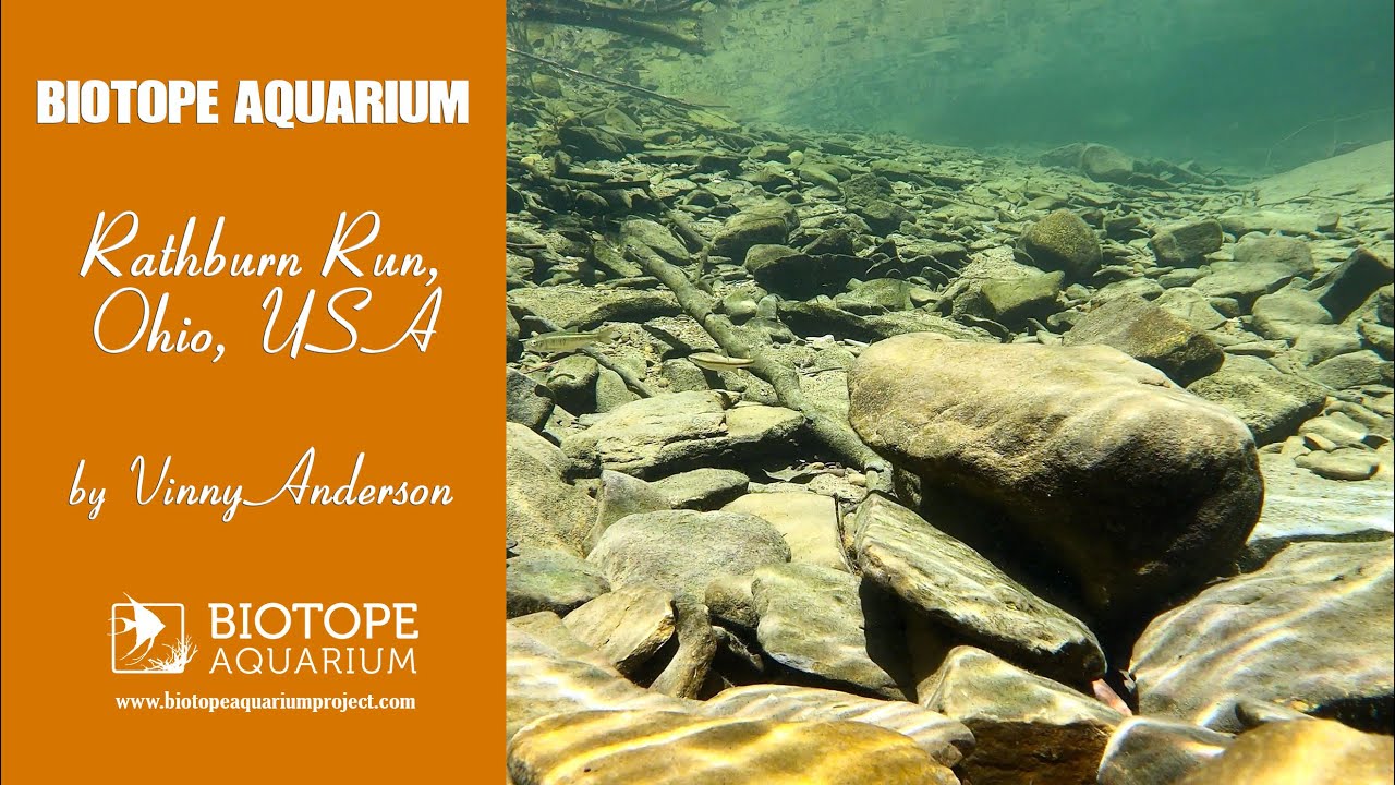
This small 7.4 km headwater stream located in Wayne County Ohio, USA, has a watershed area of approximately 16 km2 (Krolczyk). The watershed land used is agriculture and forested park land with moderate to steep sloped topography. The specific biotope is found in the mixed forested area which has multiple trail paths for recreational hiking. Average yearly rainfall is 990 mm with water temperatures range from 0-25°C seasonally.
The gravel stream bed has mix margins of mud/silt with banks lightly vegetated. The stream has varying areas of pools, riffles and runs. Deciduous trees are found on or near the bank shading most all of the stream, aiding in keeping water temperatures cool. Fallen trees create log jams and submerged wood habitat with leaf packs scattered throughout areas of the stream.
- GPS
- 40.8167076, -82.0221176
- Geographical region
- Northern America
- Drainage Basin
- Mississippi River Basin
- River catchment
- Ohio River
- Water body type
- Stream
- Water body name
- Rathburn Run
- Water body part
- Pool
- Water body course
- Headwaters
- Water body: tributary of
- Creek
- Tributary name
- Little Killbuck Creek
Videos above and below water