bin

Son River Stream, Phong Nha-Ke Bang NP

Sponsored by

Viet Nam, Phong Nha-Ke Bang National Park, Bố Trạch District, Quang Binh Province

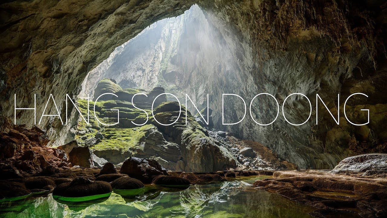
Phong Nha – Ke bang National Park is typically characterized by a tectonic limestone structure with 300 caves, underground rivers and extremely rare flora and fauna in the Vietnamese Red Book and World Red Book. Due to the Karst Phong Nha-Ke Bang natural block, the phenomenon of groundwater runoff is common.

In this region, some small streams flow into the Rao Thuong Channel with several intermittent segments opening and into the cave system as an underground river, then converge into the Chay and Son Rivers and form the largest tributary of the Gianh River. Macropodus opercularis and Barbodes semifasciolatus are species living in the stream near the Son River presented in the project. The area of Phong Nha-Ke Bang National Park is a real paradise, which inspired me to present this place with its beauty as a biotope of paradise fish in which it occurs in nature.

Submitted by
Magdalena Szubska
Approved by
Greg Martin & Peter Unmack
GPS
17.5645008, 106.2996674
Geographical region
Southeastern Asia
Drainage Basin
South China Sea
River catchment
Gianh River
Water body type
River
Water body name
Son River Stream
Water body part
Outflow
Water body course
Lower course
Water body: tributary of
River
Tributary name
Son River

Videos above and below water

Water Chemistry

Water information

Water type
Fresh water
Water color
Mixed water
Water transparency
Medium
Concentration of sediments
High
Water temperature
21 °C
Water flow/curent
Strong

Chemical parameters

pH
7.07
Conductivity
284
GH
7 mg/l
KH
5 mg/l
Dissolved Oxygen
70 %

Substrate in nature

Sand
Beige
Pebble/Gravel
Stone
Grey
Stone form
Irregular
Silt/Mud
Grey
Leaves
Many
Driftwood
Many
Submerged terrestrial vegetation
Yes

Aquatic Biotope

Date of collecting
May, 2021
Collecting area
River bank
Water depth
0,5m
Air temperature
27 °C
Sunlight
Partial shade

Environment

Environment
Untouched
Surrounding area

Phong Nha – Ke National Park is located in the middle of the Annamite mountain range southwest of the Gianh River, 40 km from Dong Hoi city, 500 km from the capital Hanoi and close to the Vietnamese-Laos border to the west. Phong Nha – Ke Bang shares the border with Hin Namno Nature Reserve (pre-World Natural Heritage) to the west, Minh Hoa district to the north, Bo Trach district to the east, and Quang Ninh district to the south.

Phong Nha-Ke Bang National Park is located in the middle of the Annamite Mountain Range in Vietnam’s Quang Binh Province and shares the border with Laos’ Hin Namno Nature Reserve to the west. The property covers an area of ​​123,326 ha and includes terrestrial and aquatic habitats, primary and secondary forest, natural regeneration sites, dense tropical forests and savannah, and is rich in large, often spectacular and scientifically significant caves.
Many animal species with high scientific and economic values can be found, such as Gaur Bos gaurus, Muntjak species Muntiacus spp., Sun Bear Helarctos malayanus, Sunda Pangolin Manis javanica, flying squirrels and many birds.

The numerous caves, abundant food sources and low human population density provide good habitats for several primate species. Nine species and sub-species of primates have been recorded at the site, which equates to 43% of the total number of Vietnam’s primate species. All these species are listed in Decree 32/2006/ND-CP dated 30 March 2006 of the Council of Ministers, and all of them are listed in the Vietnam Animal Red List (2012). The site supports four Primate taxa endemic to the Annamites including Hatinh Langur (Trachypithecus francoisi hatinhensis) and its black form (T. ebenus), Red-shanked Douc langur (Pygathrix nemaeus), White-cheeked Gibbon (Hylobates leucogonis), two spicies of Slow Loris (Nycticebus coucang), and Pygmy Loris (Nycticebus pygmaeus) which is endemic to Indochina. The property supports almost all of the total world population of Hatinh Langur and it is the most abundant species in the park. The extention area of National Park also has an abundance of monkeys with 7 species: Stump-tailed macaque, Assamse macaque, Rhesus macaque Pig-tailed macaque, Hatinh langur, Black langur and Red-shanked douc monkey. This karst area with many caves supports the largest number of bat species in Vietnam. There are 46 bat species in the park making up 43% of the total number of bat species in Vietnam. The park has great potential for bat research and conservation. This karst area with many caves supports the largest number of bat species in Vietnam. There are 46 bat species recorded in the site equivalent to 43% of the total number of bat species in Vietnam. The National Park has great potential for bat conservation. The caves also support endemic cave species of fish, the recently discovered cave scorpions and 58 cave invertebrates species showing isolation, with only five species occurring in all three caves.

Underwater landscape

The underwater landscape looks like an underwater tropical rainforest. In the coastal zone there are many roots and branches immersed in the water, even to the bottom of the stream. At the bottom a lot of sediment, fallen leaves, fruit and flowers from the surrounding trees. Aquatic vegetation is most abundant in coastal zones, forming a coherent whole of green scrub with ferns, grasses and other plants growing in the coastal zone. Aquatic vegetation is richest in places where sunlight reaches and grows quite densely in large clusters. In the stream, you can observe pieces of rocks and stones of various sizes and shapes. The whole creates an ideal habitat for many species of fish, including the paradise fish – Macropodus opercularis and Barbodes semifasciolatus. The water seems calm, sometimes not very clear in the deeper parts of the stream.

Fishes:

  • Anguilla marmorata (Anguilliformes )
  • Carassius auratus (Cypriniformes)
  • Barbodes semifasciolatus (Cypriniformes)
  • Osteochilus salsburyi (Cypriniformes)
  • Esomus metallicus (Cypriniformes)
  • Esomus longimanus (Cypriniformes)
  • Rasbora steineri (Cypriniformes)
  • Devario fangfangae (Cypriniformes)
  • Silurus asotus (Siluriformes)
  • Oreochromis niloticus (Chilidae)
  • Macropodus opercularis (Osphronemidae)

Aquatic plants:

  • Limnophila indica (Plantaginaceae)
  • Pogostemon stellatus (Lamiaceae)
  • Cryptocoryne wendtii (Araceae)
  • Pistia stratiotes (Araceae)
  • Salvinia molesta (Salviniaceae)
  • Egeria densa ( Hydrocharitaceae)
  • Eriocaulon sp. Vietnam (Eriocaulaceae)

Wetland plants:

  • Dryopteris filix-mas (Polypodiaceae)
Threats to ecology

The Park is located in one of the 200 Global Ecoregions (WWF, 2000) and within two of 62 Important Bird Area (BirdLife International 2002) . The property is one of the largest protected karst areas in Southeast Asia. Covering an area of 123,326 hectares and limited to the west by the Lao People’s Democratic Republic, all the elements necessary to demonstrate the outstanding geological qualities of Phong Nha-Ke Bang National Park are within the limits of good. The introduced real estate is entirely surrounded and protected with a buffer zone of 220,055 ha and is intended for three management zones: strict, ecological reclamation and administration and service. The protective forests of the buffer zone also protect the integrity of the property. In addition, the expansion of the property improves its integrity and connectivity with the Laos PDR karst landscape.

However, there are a number of issues that affect the integrity of property. Poaching and illegal sourcing of forest products pose a direct threat to the value of biodiversity. The property has also suffered from previous investments and its integrity may be threatened by further uncontrolled tourism investments, in particular the proposed construction of the cable car and access roads. There is a need to carry out an Environmental Impact Assessment for all projects that may have a negative impact on the site. This would ensure that the natural landscape, geological and geomorphic values and key features such as primitive forest, caves, rivers and streams within the area inscribed remain intact. The property is located in an area with a high population density, and thus in the field of cultivation, tourism.

Originally designated as a nature reserve in 1986, Phong Nha-Ke Bang National Park was created in 2001 by Decision 189 / QD-TTg by the Prime Minister and is managed by the board of directors. The management board is responsible for the protection of forest resources and biodiversity and was established in 1994. The Cultural and Ecological Tourism Center subordinate to the Management Board is responsible for the protection of caves and the provision of tourist services. The property is also entered on the Special List of National Heritage (2009) and the system of Special Use Forests (1999). A national park is effectively protected by a number of national laws and government decisions that prohibit any activity inside or outside the national park or World Heritage property that may have a significant impact on the heritage values.

The Strategic Management Plan has been in force since 2012 and is based on existing plans, including the Sustainable Tourism Development Plan, the National Park Operation Management Plan and the Buffer Zone Development Plan. The Board oversees law enforcement programs, including ranger patrols and joint law enforcement operations at the PDR border with Laos. Nevertheless, the country’s rugged nature and community dependence on natural resources, combined with relatively limited enforcement measures, mean that poaching and illegal logging are difficult to combat and remain a challenge.

Ho Chi Minh Highway, built on the outside and north of the property, is well located and provides important and valuable benefits to the National Park in terms of opening views and accessing the Ke Bang Forest area. However, other road construction and tourism development will require a rigorous and comprehensive environmental impact assessment before deciding to grant or refuse a permit. It is extremely important that such changes do not affect the karstic and biological values ​​for which the property is listed. The effects of increased development pressures and the number of tourists will also require ongoing consideration, planning and management to ensure that these pressures do not detract from the Outstanding Universal Value of the property.

Riparian zone

Trees near the aquatic habitat
Many - Not identified

Comment by the expert

Greg Martin: Excellently researched. A first class entry.

Peter Unmack: Really loved the video links provided. Good level of details provided.