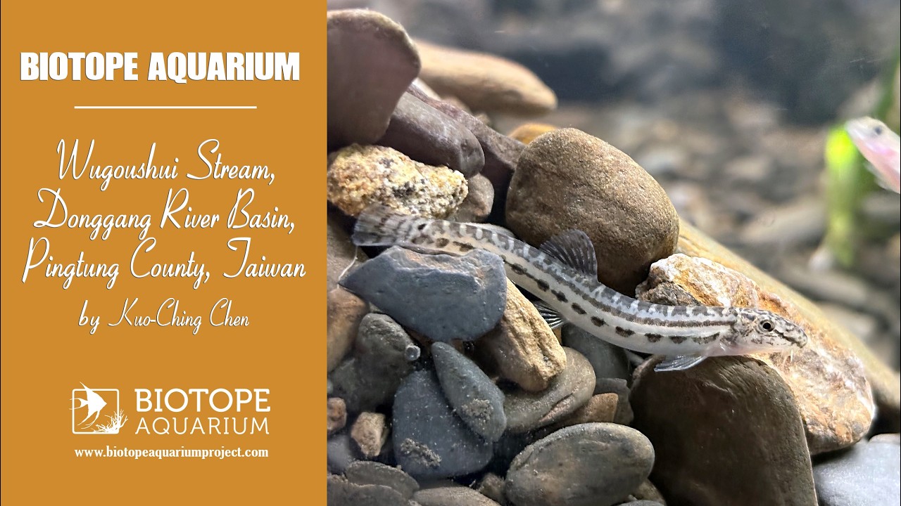
- Set-up date
- June, 2026
- Aquarium decoration
This layout is designed around the structure of a natural spring-fed stream. The main composition consists of a winding U-shaped channel, with elevated sand and gravel banks on both sides and a lower open watercourse in the centre. This stream-profile approach was selected to represent the topography and hydrological processes of a real spring-fed ecosystem, including the effects of current, erosion, sediment transport, and deposition.
A bottom-up water inflow system is used to simulate groundwater emerging from beneath the streambed. Water enters through the substrate and flows along the curved channel, creating different current conditions throughout the aquarium. The front section and the main bend experience stronger visible flow, while other areas remain calmer, providing a range of microhabitats suitable for different aquatic organisms.
The stones used in the aquarium were collected from the original stream habitat and retain similar colour, texture, and shape to the natural streambed. The substrate consists of a mixture of sand, fine gravel, rounded stones, and larger rocks, recreating the uneven structure of a natural stream environment. Excess fine mud was removed before setup to maintain water clarity and stability, while the spaces between stones and gravel were preserved as shelter and foraging areas for benthic organisms.
A limited amount of fine sediment was intentionally retained in selected areas to represent natural deposition zones. This maintains the ecological character of the streambed while preventing excessive turbidity. Emergent and marginal plants from the surrounding habitat were also incorporated above the water surface to recreate the transition between aquatic and terrestrial environments. These plants provide additional cover, enhance habitat complexity, and create a more natural connection between the stream and its banks.
To achieve a faithful biotope representation, the design focuses on habitat structure rather than decorative composition. The streambed, gravel banks, water margin, bank vegetation, and underwater environment are integrated into a continuous ecological system. The goal is to reproduce a small-scale section of a real spring-fed stream while preserving its natural irregularity, flow patterns, and ecological character.
Fish:
- Rhinogobius macromaculatus (Gobiidae) – 20
- Barbodes semifasciolatus (Cyprinidae) – 20
- Cobitis sinensis (Cobitidae) – 50
Aquatic plants:
- Limnophila pingtungensis (Plantaginaceae) – 1
- Vallisneria natans (Hydrocharitaceae) – 3
Wetland plants:
- Kyllinga nemoralis (Cyperaceae) – 10
- Equisetum ramosissimum (Equisetaceae) – 6
- Aquarium equipment
The aquarium is connected to a large recirculating water system with a total volume of approximately 10 tons. Filtration is provided by three 200 L filter chambers, which function as biological filtration units. The water flow rate is approximately 3,000 L/h. Based on the aquarium’s actual display volume of around 162 L, this results in a turnover rate of approximately 18.5 times per hour.
Water is introduced from beneath the substrate on the left side of the aquarium to create a bottom-up spring simulation, representing groundwater emerging through the streambed. This system provides stable water parameters, efficient biological filtration, and a flow pattern suitable for recreating the conditions of a spring-fed stream habitat.
- Fish care
The primary goal of fish care in this aquarium is to provide an environment that allows natural behaviours to develop as closely as possible. The layout recreates a shallow spring-fed stream, incorporating a winding U-shaped channel, bottom-up water inflow, natural current zones, gravel substrate, stones, and marginal plant cover.
The shallow water depth and flowing channel are designed to reflect the conditions of the original habitat. The current provides suitable swimming and feeding areas for active species such as Barbodes semifasciolatus, while calmer zones offer resting and sheltering areas. Vallisneria natans provides soft plant cover and additional structure, helping fish remain secure and display natural activity patterns.
Stones and gravel are essential components of the habitat structure. They create crevices, shaded areas, and diverse bottom surfaces used for shelter, resting, foraging, and territorial behaviour. Rhinogobius macromaculatus uses stones and sheltered spaces for perching and establishing territories, while Cobitis sinensis utilises the sandy and gravel substrate for hiding and searching for food.
As a benthic species, Cobitis sinensis also contributes to the ecological function of the aquarium. Its movement through the sand and gravel while foraging helps disturb fine sediment layers and reduces the accumulation of organic material in low-flow areas.
Feeding is based on a varied diet including bloodworms, daphnia, and prepared foods. Live and frozen foods provide natural feeding stimulation, while prepared feed ensures consistent nutritional intake. This balanced feeding approach supports healthy growth, natural behaviour, and overall fish condition.
- Plant care
The aquatic plants used in this aquarium are species that naturally occur in lowland spring-fed stream environments. Vallisneria natans is a robust submerged plant that can grow successfully under stable water conditions, suitable lighting, and sufficient space without requiring intensive maintenance. It also provides shelter and structural complexity for fish and other aquatic organisms, contributing to a more natural underwater environment.
The primary conservation focus of this aquarium is the native Pingtung Limnophila (Limnophila pingtungensis nom. nud.). In its natural habitat, this plant does not require intensive care but depends on suitable light conditions, clean water, moist substrate, and a stable environment with limited disturbance and competition. Therefore, plant management in this aquarium focuses not on intensive fertilisation or frequent trimming, but on maintaining ecological conditions that allow the species to grow naturally.
During field surveys, the original habitat showed signs of riverbed modification, and only a single small individual of native Pingtung Limnophila was recorded. This suggests that the decline of this plant is likely associated primarily with habitat alteration and competition from invasive or more vigorous plant species rather than with difficulties in cultivation.
To support its growth, the aquarium provides approximately 12 hours of daily lighting, stable water quality, and suitable moist marginal areas. Vallisneria natans functions as an initial stabilising plant, but it will be periodically reduced when necessary to prevent excessive competition for light and space with Limnophila pingtungensis.
Emergent and marginal plants are also temporarily incorporated to provide additional cover and create a more natural transition between aquatic and terrestrial zones. As Limnophila pingtungensis gradually establishes itself, these temporary bank plants will be reduced or removed, allowing the native Limnophila to become the dominant plant species within the aquarium.
- Water care
The display aquarium contains approximately 162L of actual water volume and is connected to a large recirculating water system of approximately 10 tons. This system has been operated and maintained stably for around six years. Biological filtration is provided by three 200 L filter chambers, with a total water flow rate of approximately 3,000L/h. Based on the display volume, the turnover rate is approximately 18.5 times per hour.
Water management in this aquarium focuses on long-term stability rather than frequent intervention. The large total system volume helps minimise sudden fluctuations in water parameters and temperature, while the biological filtration system maintains clear and suitable conditions for stream-dwelling fish and aquatic plants. The water temperature is maintained at approximately 24°C, closely matching the conditions of the natural spring-fed habitat.
A partial water change of approximately 10% of the entire 10-ton recirculating system is performed every two weeks, equivalent to around 1.000 L per maintenance cycle. Routine care also includes monitoring water level, clarity, flow conditions, fish behaviour, and plant growth. Excess organic material or accumulated fine sediment is removed only when necessary, while avoiding excessive disturbance to the gravel substrate, stones, and established habitat structure.
The objective of water management is to maintain a clean, stable, and well-circulated environment while preserving the natural characteristics of a spring-fed stream ecosystem. This approach allows both fish and plants to thrive under conditions closely resembling their original habitat.