Lake Sentarum is a seasonal floodplain lake system and one of the most biologically diverse lake regions in the world. Located in the upper Kapuas River tectonic basin, about 700km upstream from the delta, the basin forms a vast floodplain composed of around 20 seasonal lakes, freshwater swamp forests, and peat swamp forests.
During the rainy season (October-May), the Kapuas River rises and backs up into the lake system, causing the lakes and marshes of Sentarum to expand considerably. In the dry season (June-September), the river level drops, and the water in Lake Sentarum recedes, exposing shallow areas and leaving behind smaller, often isolated lakes.
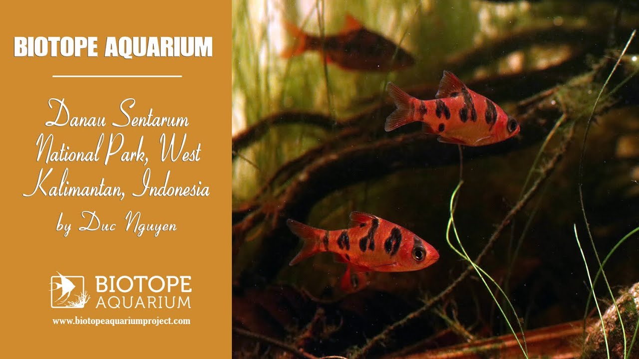
In summary, Lake Sentarum functions as a natural reservoir, helping to regulate the flow and flooding of the Kapuas River. At the same time, the Kapuas River serves as the lake’s primary water source. This dynamic system creates an ideal habitat for fish species that thrive in soft, acidic water, such as gouramis, rasboras, barbs, and loaches.
- GPS
- 0.6902226, 112.1531906
- Geographical region
- Southeastern Asia
- Drainage Basin
- South China Sea
- River catchment
- Kapuas
- Water body type
- Wetland
- Water body name
- Swamp
- Water body part
- Flood plain
- Water body course
- Middle course
- Water body: tributary of
- River
- Tributary name
- Kapuas river
Videos above and below water