bin
Igarapé do Daracua near Barcelos, Brasil
Brazil, Amazonas, Barcelos
Igarapé do Daracuá is a blackwater forest creek of the middle Rio Negro, approximately 10 km upstream from Barcelos, Amazonas, Brazil. This seasonal igarapé flows through pristine igapó flooded forest, characterized by extreme conditions: pH 3.8-4.5, near-zero hardness, and visibility of less than 30 cm due to tannins released from decomposing Mauritia flexuosa palm fronds. The substrate consists entirely of organic detritus, with no exposed sand or mineral material.
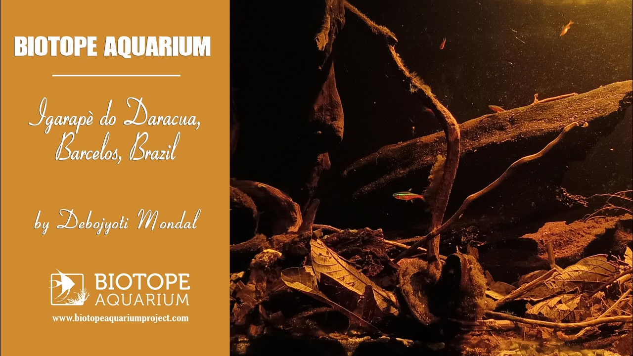
The biotope replicates a dry-season leaf-pack zone where Paracheirodon axelrodi forms monospecific schools exceeding 50 individuals/m³. True aquatic plants are absent; habitat structure is derived entirely from allochthonous organic input. Historical ornamental fish collection has made the Cardinal Tetra globally famous, yet its natural habitat remains poorly protected. This aquascape honors the ecological reality of its environment: a tea-colored, plantless, acidic world where leaf litter is essential for ecosystem function.
- Submitted by
- Debojyoti Mondal
- Approved by
- Roberto E. Reis, Pablo C. Lehmann & Antonio Machado-Allison
- GPS
- -0.1415000, -63.1858826
- Geographical region
- South America
- Drainage Basin
- Rio Amazonas
- River catchment
- Rio Negro
- Water body type
- Igarapè
- Water body name
- do Daracua
- Water body part
- River mouth
- Water body course
- Lower course
- Water body: tributary of
- River
- Tributary name
- Rio Negro
Videos above and below water
Warning: Undefined variable $fish_parent in /home/biotopea/public_html/wp-content/themes/bap/content-bin.php on line 55
Water Chemistry
Water information
- Water type
- Freshwater
- Water color
- Black water
- Water transparency
- Medium
- Concentration of sediments
- Medium
- Water temperature
- 28 °C
- Water flow/curent
- Slow
Chemical parameters
- pH
- 4
- Conductivity
- 40
- GH
- dGH
- KH
- dKH
- Dissolved Oxygen
Substrate in nature
- Sand
- Beige
- Pebble/Gravel
- None
- Stone
- None
- Stone form
- Silt/Mud
- Beige
- Leaves
- Adundant
- Driftwood
- Many
- Submerged terrestrial vegetation
- None
Aquatic Biotope
- Date of collecting
- Collecting area
- River bank
- Water depth
- Air temperature
- Sunlight
- Full sun
Environment
- Environment
- Affected by human activity
- Affected by human activity
- Deforestation
- Deforestation
- Advanced
- Surrounding area
Igarapé do Daracuá is located within a primary Amazonian igapó flooded forest, approximately 10 km upstream of Barcelos, Amazonas, Brazil (0°58′ S, 62°55′ W). It forms part of the middle Rio Negro Basin within the Brazilian Amazon.
The surrounding vegetation consists of dense flooded forest with more than 90% canopy cover, dominated by Mauritia flexuosa (buriti palm), Euterpe precatoria, Hevea brasiliensis, and Leopoldinia piassaba. The igarapé experiences approximately six months of seasonal flooding each year.
Annual rainfall exceeds 2,500 mm, while temperatures remain between 27-29 °C throughout the year, with relative humidity typically above 85%. The nearest human settlement is the municipality of Barcelos. There are no roads, agriculture, or industrial activities within approximately 50km.
The area is protected under the Brazilian Forest Code as a Permanent Preservation Area and provides important habitat for migratory birds and endemic blackwater fish species.
- Underwater landscape
The underwater habitat consists exclusively of allochthonous organic material, with no exposed mineral substrate. The streambed is formed by 15-30 cm deep accumulations of decomposing leaf litter, seed pods, and submerged branch tangles. True submerged macrophytes are absent due to less than 1% surface PAR penetration and the acidic water (pH 3.8-4.5).
The water is tea-coloured by dissolved tannins, with a conductivity of 8-12 µS/cm and visibility of less than 30 cm. A flow velocity of less than 5 cm/s creates stagnant leaf-pack microhabitats that become isolated during the dry season.
Paracheirodon axelrodi occupies these leaf-litter zones in monospecific schools exceeding 50 individuals/m³, using the detritus for predator avoidance and foraging on fungal and bacterial biofilms (Knöppel, 1970). No sand, gravel, or rock is present within this cardinal tetra microhabitat.
- Threats to ecology
-
Riparian zone
- Trees near the aquatic habitat
-
Many -
Comment by the expert
Roberto E. Reis: Good description of the location, both terrestrial and aquatic habitat and surrounding area. A single video of habitat and aquarium. Only one species of fish listed. Bibliography and sitography rather poor.
Pablo C. Lehmann: The entry is impressively specific about location, flooded-forest vegetation, seasonality, climate, protection and regional threats. The underwater microhabitat description is detailed and ecologically focused. However, the listed biodiversity is essentially a single focal species (Paracheirodon axelrodi), so the faunal/floral inventory is not comprehensive. There are also internal inconsistencies: the form reports beige sand and conductivity of 40, whereas the narrative states no exposed mineral substrate and conductivity of 8-12 µS/cm. The bibliography includes a highly relevant classic Rio Negro reference but is otherwise very limited.
Antonio Machado-Allison: Good.