bin
Papeno’o River, Tahiti, French Polynesia
Paraguay, Tahiti, Papeno'o
The Papeno’o River is a small hill stream in northern part of island Tahiti, in French Polynesia.
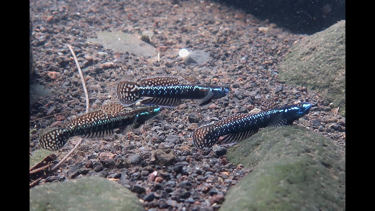
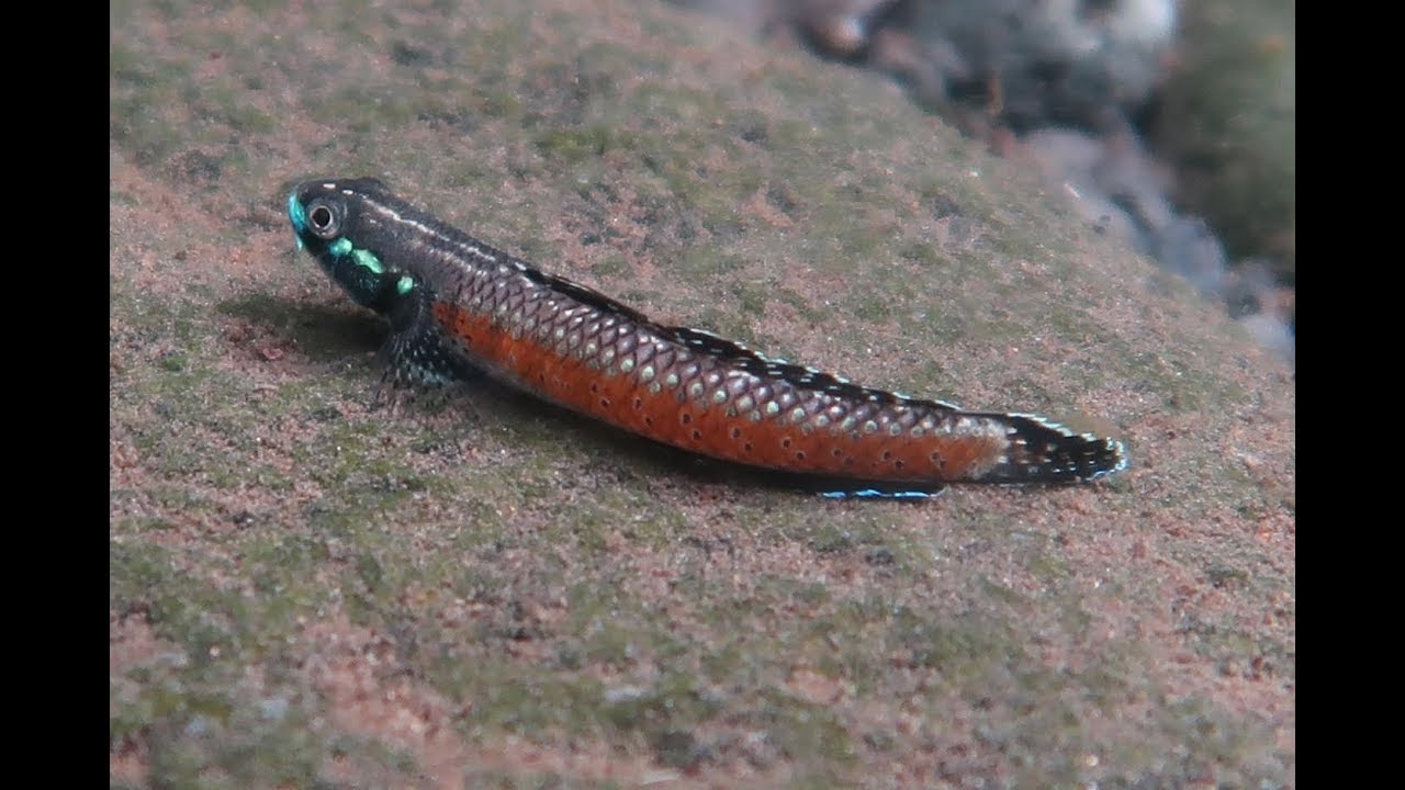
The river forms on the moutain Mont Orohena and ends in the Pacific Ocean. This fast flowing volcanic river is home for different spieces of Sicydiinae subfamily.
Former name was Vaituaru, meaning: “the stream that destroys everything in its path”. This name reffers to spring season, when snow from moutains melts and the river overflows its banks.
- Submitted by
- Matěj Novák
- Approved by
- Heok Hee Ng & Greg Martin
- GPS
- -17.5805454, -149.4240112
- Geographical region
- South America
- Drainage Basin
- North Coast
- River catchment
- Papeno'o River
- Water body type
- hill-streams
- Water body name
- Papeno'o River
- Water body part
- Rapids
- Water body course
- Upper course
- Water body: tributary of
- Hill streams
- Tributary name
- Papeno'o River
Videos above and below water
Warning: Undefined variable $fish_parent in /home/biotopea/public_html/wp-content/themes/bap/content-bin.php on line 55
Water Chemistry
Water information
- Water type
- fresh-water
- Water color
- Clear water
- Water transparency
- High
- Concentration of sediments
- Low
- Water temperature
- 26,4 °C
- Water flow/curent
- Strong
Chemical parameters
- pH
- 7.0
- Conductivity
- 180
- GH
- 90 mg/l
- dGH
- KH
- dKH
- Dissolved Oxygen
- 11 %
Substrate in nature
- Sand
- Beige
- Pebble/Gravel
- Black
- Stone
- Black
- Stone form
- Roundish
- Silt/Mud
- None
- Leaves
- Few
- Driftwood
- Few
- Submerged terrestrial vegetation
- Yes
Aquatic Biotope
- Date of collecting
- July, 2018
- Collecting area
- Shore line
- Water depth
- 0,5m
- Air temperature
- 27 °C
- Sunlight
- Full sun
Environment
- Environment
- Untouched
- Surrounding area
Papeno’o Valley is largest valley in Tahiti, French Polynesia. It gose down from the centre of island and ends north in Pacific Ocean. Main river, Papeno’o flows from Mont Orohena (highest moutain on Tahiti).
Rivers flows down the hilly rainforest full of various tropical trees and plants. It has over 35 tributaries and many waterfalls. Number tributaries gives valley name Ha’apai’ano’o, “the gathering of all waters”.
Elevation goes from over 2.200. to 0,6m what causes high water flow. Unexpected thunderstorms above the moutains in centere of Pacific Ocean causing quick floods and river can be very dangerous.
- Underwater landscape
The watercourse is lined with rocky shore and rainforest. Roots of trees and plants growing near the water grow through shore and make only vegetation and hiding spots in river trough.
As mentioned river is rocky, filled with black or dark gray boulders and pebbles overgrown by algae which is main source of food for fresh water gobies. Substrate is vulcanic source. That’s mean it is very light and and easily carried by the current.
Driftwood and leaves can be found in slow flowing lagoons or stuck under boulders. Behind big boulders where the current is slow can be spoted fine sediment. This sediment contains micro-organisms which is another form of food important for fresh water gobies.
Fishlist:
- Stiphodon elegans (Oxudercidae)
- Sicyopterus pugnans var. Blue (Oxudercidae)
- Sicyopterus pugnans var. Orange (Oxudercidae)
- Anguilla megastoma (Anguilliformes)
- Sicyopterus lagocephalus (Oxudercidae)
Molluscs:
- Clithon corona (Neritidae)
- Nereina punctulata (Neritidae)
Crustaceans:
- Macrobrachium sp. (Palaemonida)
- Threats to ecology
Rivers of Papeno’o Valley have historicaly great imapct on people of Tahiti. This valley is know for locals by name Te Mano Rahi (the 10.000 warriors) because for several centuries, it was a living space of great Tahitian chiefdoms.
River basin provides home for many beautiful fishes and water creatures, who needs acces to salt water due to reproduction. Also is main saurce of water and food for almost 100 of birds.
Riparian zone
- Trees near the aquatic habitat
-
Many -