bin
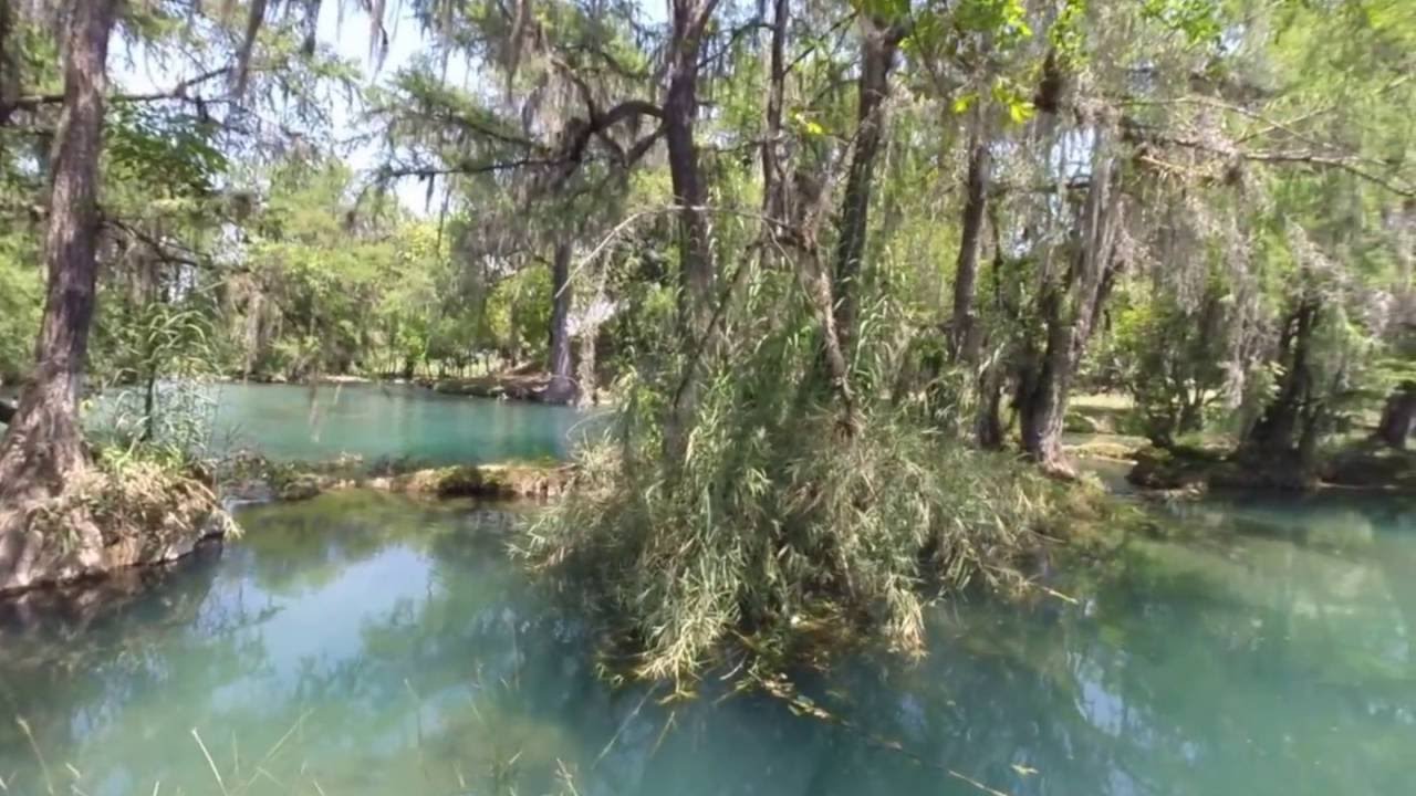
Rio Tamasopo, San Luis Potosi, Mexico
Mexico, San Luis Potosi, Tamasopo
The Río Tamasopo is a river that originates from multiple sources. Initially, it flows into the Río Gallinas and then continues its course towards the Río Tampaón. Finally, it converges with the Río Pánuco, culminating its journey as it reaches the Mexican Gulf.
The surroundings of the river are covered with tropical evergreen forest. The climate remains warm throughout the year, with temperatures ranging from 25 to 30°C.
The water level drops significantly during the dry season, which lasts approximately from October until end of May. During the rainy season, the water level rises again, and the rivers’ currents become too strong, making it difficult to enter the water.
In Tamasopo, there is a main pool, similar to those found in many other biotopes in the area. Cascadas de Tamasopo (waterfall) falling down to this pool. This location serves as a recreational area for the local community during holidays and weekends, particularly in the dry season.
- Submitted by
- David Nørholm
- Approved by
- Juan M. Artigas Azas, Jairo Arroyave & Michael Köck
- GPS
- 21.9396496, -99.3965378
- Geographical region
- Central America
- Drainage Basin
- Pánuco River Basin
- River catchment
- Tamasopo River Basin
- Water body type
- River
- Water body name
- Rio Tamasopo
- Water body part
- Channel
- Water body course
- Middle course
- Water body: tributary of
- River
- Tributary name
- Río Tampaón
Videos above and below water
Warning: Undefined variable $fish_parent in /home/biotopea/public_html/wp-content/themes/bap/content-bin.php on line 55
Water Chemistry
Water information
- Water type
- fresh-water
- Water color
- Clear water
- Water transparency
- High
- Concentration of sediments
- Medium
- Water temperature
- 20-25 °C
- Water flow/curent
- Slow
Chemical parameters
- pH
- 8.0
- Conductivity
- GH
- 125 mg/l
- dGH
- KH
- 8 mg/l
- dKH
- Dissolved Oxygen
- 85 %
Substrate in nature
- Sand
- Beige
- Pebble/Gravel
- Grey
- Stone
- Grey
- Stone form
- Roundish
- Silt/Mud
- Beige
- Leaves
- Many
- Driftwood
- Many
- Submerged terrestrial vegetation
- Yes
Aquatic Biotope
- Date of collecting
- 30/10/2020
- Collecting area
- River bank
- Water depth
- 1,0m
- Air temperature
- 26 °C
- Sunlight
- Full sun
Environment
- Environment
- Affected by human activity
- Affected by human activity
- Agriculture
- Agriculture
- Advanced
- Surrounding area
The surrounding area of Rio Tamasopo is characterized by lush and diverse natural landscapes. It is typically covered with tropical vegetation, including dense evergreen forests, abundant plant life, and vibrant vegetation. The region is known for its rich biodiversity, with a wide variety of plant and animal species.
The climate in the area is generally warm throughout the year, with temperatures ranging from approximately 25 to 30 degrees Celsius. This favorable climate supports the growth of a thriving ecosystem and contributes to the beauty of the surroundings.
The terrain near Rio Tamasopo often features hills, valleys, and rugged landscapes. The river itself carves its way through the terrain, creating cascades, waterfalls, and natural pools that are popular attractions for locals doing the dry season.
During the rainy season the river is undergoing significantly changes. As the water level rises the riverbeds become flooded, carrying a considerable amount of sediment that clouds the water, rendering it impossible to see anything beneath the surface. In this period water parameters changes as well, making big seasonable changes for the fish as well.
- Underwater landscape
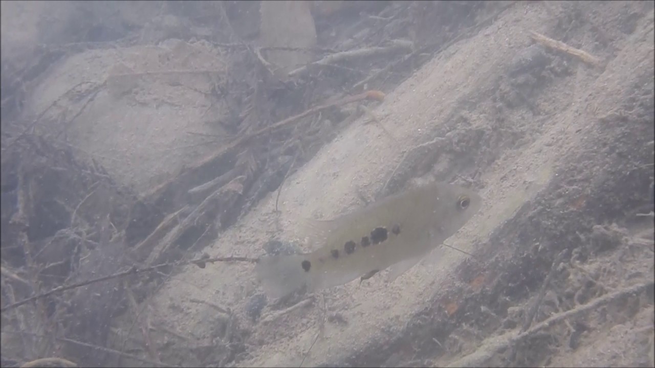
The underwater realm of Rio Tamasopo reveals a fascinating array of fish species. Among the diverse inhabitants, we can encounter:
- Xiphophorus montezumae (Poeciliidae)
- Poecilia mexicana (Poeciliidae)
- Herichthys tamasopoensis (Cichlidae)
- Astyanax mexicanus (Characidae)
Xiphophorus montezumae, aptly named after the Aztec emperor Moctezuma I, boasts an impressive feature known as the Montezuma swordtail. This unique extension exhibits remarkable proportions, often growing up to two-thirds the length of the fish’s body. It is not uncommon to witness specimens measuring around 5-6cm in length, with awe-inspiring swords stretching 7-9cm.
The primary pool experiences near stagnant currents, enriched with oxygen due to the mesmerizing flow of the Tamasopo waterfall cascading into it.
Vegetation within the rivers and primary pool is moderate, mainly comprising algae, brushes, and shrubs along with some submerged grassy types of vegetation, that gets covered doing the raise and fall of the rivers waterlevel.
The rest of the biotope is adorned with rocks, logs, and fallen leaves from the surrounding trees. The bottom substrate also varies, with the main pool consisting mainly of coarse gravel, while the rivers feature finer sand to medium-sized gravel. In some areas, there are sections with a mountainous bottom, particularly before the waterfalls.
Overall, Rio Tamasopo offers an exceptional opportunity to observe fish in their natural habitat, showcasing the diverse underwater landscape of the region.
Fishlist:
- Xiphophorus montezumae (Poeciliidae)
- Poecilia mexicana (Poeciliidae)
- Herichthys tamasopoensis (Cichlidae)
- Astyanax mexicanus (Characidae)
- Poeciliopsis gracilis (Poeciliidae)
- Tampichthys catostomops (Cyprinidae)
- Herichthys pame (Cichlidae)
- Herichthys steindachneri (Cichlidae)
Aquatic plants:
- Ceratophyllum demersum (Ceratophyllaceae)
- Bacopa monnieri (Plantaginaceae)
- Marsilea mollis (Marsileaceae)
- Ludwigia peploides (Onagraceae)
Wetland plants:
- Setaria geniculata (Poaceae)
- Arundo donax (Poaceae)
- Threats to ecology
The delicate ecology of Rio Tamasopo faces numerous threats, primarily stemming from human activities such as tourism and deforestation. The influx of tourists, while bringing economic benefits, can exert significant pressure on the ecosystem. The area around the main pool is extremely popular with both locals and tourists who use it to bathe and relax. There is also a camp site located close to the area, which also contributes to pressure on the ecosystem.
Deforestation, driven by various factors including agriculture, logging, and urbanization, poses a severe challenge to the ecological stability of Rio Tamasopo. The clearing of forests along the riverbanks not only diminishes the natural beauty of the area but also results in the loss of critical habitats for numerous plant and animal species. From 2002 to 2021, Tamasopo lost 1.73kha of humid primary forest, making up 25% of its total tree cover loss in the same time period.
Riparian zone
- Trees near the aquatic habitat
-
Many -
Comment by the expert
Michael Köck: Habitat description and additional information are accurate and well presented in an understandable way. I however would have loved to see more literature cited to cover the invertebrate fauna and I miss a few fish species.
Juan M. Artigas Azas: I found the description very good, with just some minor errors when it comes to the list of fish species present in the habitat, for example, Poeciliopsis gracilis is exotic in the habitat, and Tampichthys rasconis is not mentioned.
Jairo Arroyave: Research on the BIN seems sufficient, although underwater photos and videos were not of the best quality. I understand the limitation of the author to visit and document these habitats, though. Description of the biotic component (fish and plant species) seems accurate.