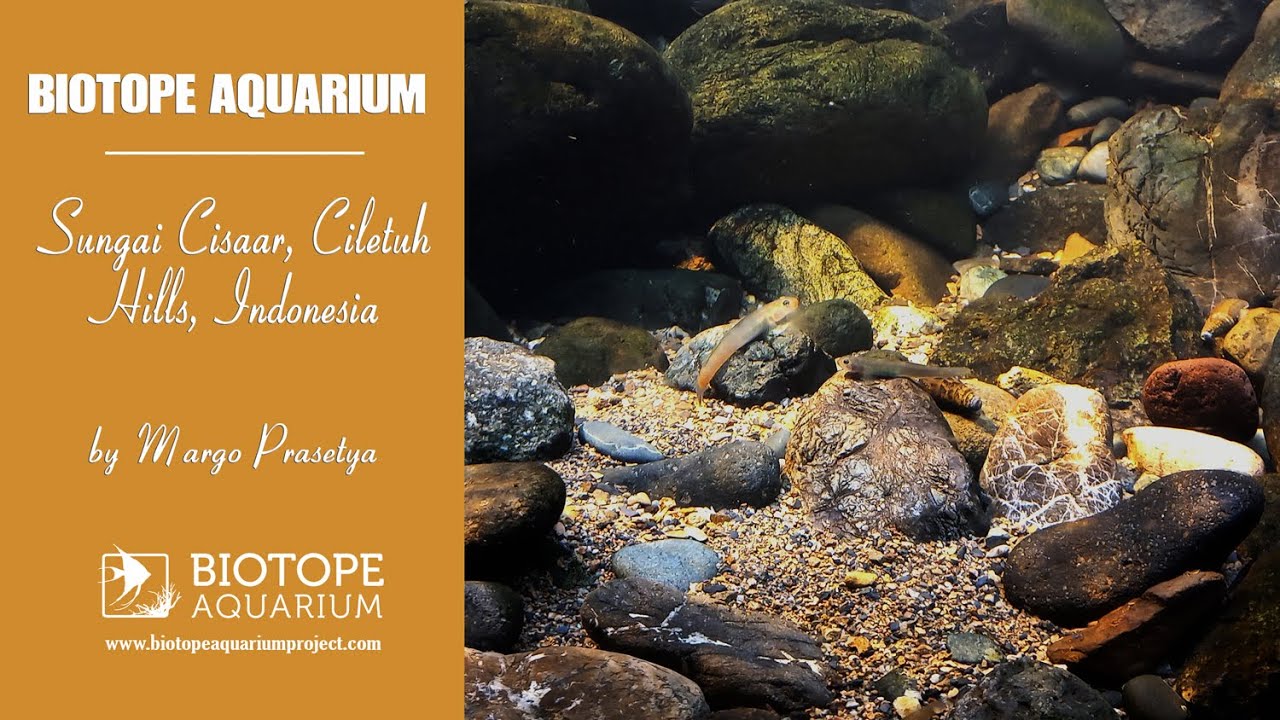
The biotope in the Ciletuh Geopark area, located in the southern part of Sukabumi, is very different from the typical biotopes in other parts of Java. Geomorphologically, the landscape of Ciletuh and its surroundings is part of the Southern Mountains of Java, forming a giant horseshoe-shaped amphitheater consisting of undulating mountains with highly varied elevations, with the highest peak reaching 360 meters above sea level (MASL).
Along the fault line, there are eight main waterfalls, one of which is Curug Larangan, located along the Cisaar River. The geological history and geographical features of this area have led to habitat isolation, particularly in the rivers near the waterfalls, which are isolated habitats and home to a type of goby fish (Sicydiinae) that is better adapted to living in the strong currents of rocky rivers.
- GPS
- -7.1877022, 106.5014343
- Geographical region
- Southeastern Asia
- Drainage Basin
- Sungai Muara
- River catchment
- Water body type
- Stream
- Water body name
- Sungai Cisaar
- Water body part
- Water body course
- Lower course
- Water body: tributary of
- River
- Tributary name
- Sungai Muara
Videos above and below water