bin

Kalchik river, Ukraine

Sponsored by

Ukraine, Donetsk region, Mariupol

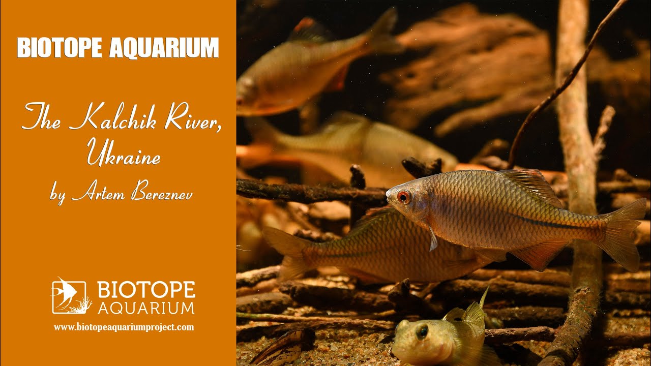
The Kalchik River is the right tributary of the Kalmius River, flowing through the territory of the Donetsk region of Ukraine.

Kalchik flows into Kalmius 6 km from its mouth. Length – 88 km, catchment area – 1.263 km². Water consumption ranges from 3.0 to 30 m³ / sec. The tributary is Maliy Kalchik. Mirror carp, grass carp, silver carp and other fish are found in Kalchik.

Submitted by
Artem Bereznev
Approved by
Alexey Malyshev & Philippe Chevoleau
GPS
47.1199989, 37.6100006
Geographical region
Eastern Europe
Drainage Basin
Drainage area - is 1.263 km²
River catchment
Water body type
River
Water body name
Kalchik River
Water body part
River mouth
Water body course
Lower course
Water body: tributary of
Tributary name

Videos above and below water

Water Chemistry

Water information

Water type
Fresh water
Water color
Clear water
Water transparency
Medium
Concentration of sediments
Low
Water temperature
22 °C
Water flow/curent
Slow

Chemical parameters

pH
7.8
Conductivity
1200
GH
30 mg/l
KH
7 mg/l
Dissolved Oxygen
5 %

Substrate in nature

Sand
Grey
Pebble/Gravel
Stone
Grey
Stone form
Irregular
Silt/Mud
Black
Leaves
No
Driftwood
Few
Submerged terrestrial vegetation
No

Aquatic Biotope

Date of collecting
12.07.2020
Collecting area
River bank
Water depth
2,0m
Air temperature
26 °C
Sunlight
Full sun

Environment

Environment
Affected by human activity
Agriculture
Agriculture
Massive
Surrounding area

The Kalchik River flows on the territory of Ukraine through the Donetsk region. The city of Mariupol is located on its banks.

Underwater landscape

The relief of the basin is predominantly flat, moderately crossed by ravines and gullies. The river bed is branched, meandering, and in places very winding. The river flow speed is from 0.4 m / s to 1.5 m / s. The nature of the current is varied throughout. In the upper reaches it has a weakly expressed mountain character, in the lower reaches it is a typical steppe species. In the upper and middle reaches, the character of the shores is mountainous and treeless, in the lower shores are low with sparse trees, in some places there are thickets of reeds. The floodplain of the river is two-sided, in places of narrowing of the valley it is absent, the width of the floodplain is from 150 m to 2 km. The bottom is stony and clayey, covered with a layer of silt.

Fishes:

  • Rhodeus sericeus
  • Neogobius melanostomus
  • Rutilus rutilus
  • Ponticola platyrostris

Wetland plant:

  • Phragmites sp.
  • Typha sp.

Aquatic plant:

  • Ceratophyllum sp.

Aufwuchs on Salix willow (Salicaceae)

Threats to ecology

In the upper and middle reaches, Kalchik is polluted with Mariupol household wastewater, as well as salts washed away from agricultural areas. The water contains an increased content of oil products and non-volatile phenols. Water salinity increases from source to mouth. Near the mouth, mineralization reaches 2.5 g / l.

Comment by the expert

Alexey Malyshev: In general, the biotope is well studied, but there is a big mistake in the work. Rhodeus amarus lives in this river. Rhodeus sericeus lives in East Asia. Earlier, the European bitter pot was considered a subspecies of the Far Eastern bitter pot, but today most scientists distinguish it as a separate species.

Philippe Chevoleau: Nice job regarding your research on the aquatic biotope. Well documentted. It’s nice to get so much information about a locality. I wish there could have been some sources (biography, sitography) in English, but I understand that it’s not easy to find, if it exists. So, congratulations.